
Prepare for the summer heat!
MACON, Georgia (41NBC/WMGT) – Temperatures will reach into the 90s across Middle Georgia beginning Wednesday afternoon, climbing the rest of the week.
Tonight
The coolest night of the week has arrived in Middle Georgia as it’s the only night most locations should drop below 70 degrees. The wind will be light out of the south under mostly clear skies. Patchy fog is possible rolling into the sunrise Wednesday.
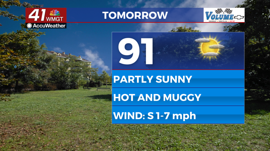
Tomorrow
The sunshine will be back around Middle Georgia following a couple of cloudier days to begin the work week. Expect high temperatures largely in the lower 90s with heat indexes reaching into the mid-upper 90s. A light southeasterly wind is expected to continue throughout the day. Rain odds will be a lot lower than Monday and Tuesday, however a couple showers or a storm are possible over the back half of the day. Those spending time outdoors should hydrate and wear sunscreen.


Overnight will be muggy and mostly clear with temperatures reaching their valley in the lower 70s. The wind will be light and variable with patchy fog possible heading into the start of Thursday.
Thursday and Beyond
Partly sunny skies are likely Thursday and Friday with isolated storms possible both afternoons. The rain odds do look a bit higher for Friday and into the weekend with more than half of the region likely seeing storms beginning Friday afternoon. Temperatures will climb with the storm odds as highs in the mid-upper 90s look likely to finish the work week. Those will be accompanied by heat indexes reaching the upper 90s and low triple digits.

Follow Chief Meteorologist Aaron Lowery on Facebook (Aaron Lowery 41NBC) and X (@ALowWX) for weather updates throughout the day. Also, you can watch his forecasts Monday through Friday on 41NBC News at 4, 5, 5:30, 6, and 11 p.m.