
Warmer weather arrives Wednesday in Middle Georgia
High pressure once again kept us dry and mild across the area today, but we managed to keep our highs relatively cool.
These cooler days are on their way out as we head through the rest of the week. High pressure will push further off to the east and as it does warmer air will filter back into Middle Georgia.
High temperatures will be warming back into the 80’s tomorrow and stay warm through the rest of the week.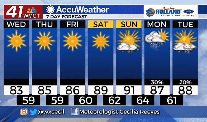
We will be staying dry through the weekend as the general trend of high pressure over Middle Georgia settles in. This high pressure will also allow for a big warm up back to the upper 80’s and low 90’s.
Our next chance of rain and storms won’t be until the start of next week, and even then it doesn’t look like we will be seeing widespread shower action.
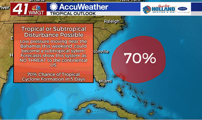
In other news, we are also already tracking our next potential subtropical system as an area of low pressure moves near the Bahamas.
This area of low pressure has a 70% chance of becoming a subtropical storm in the next five days. The good news for us is that this will be moving away from the east coast and shouldn’t be a threat for the southeast.

Leave a Reply