T-storms bring relief for the weekend
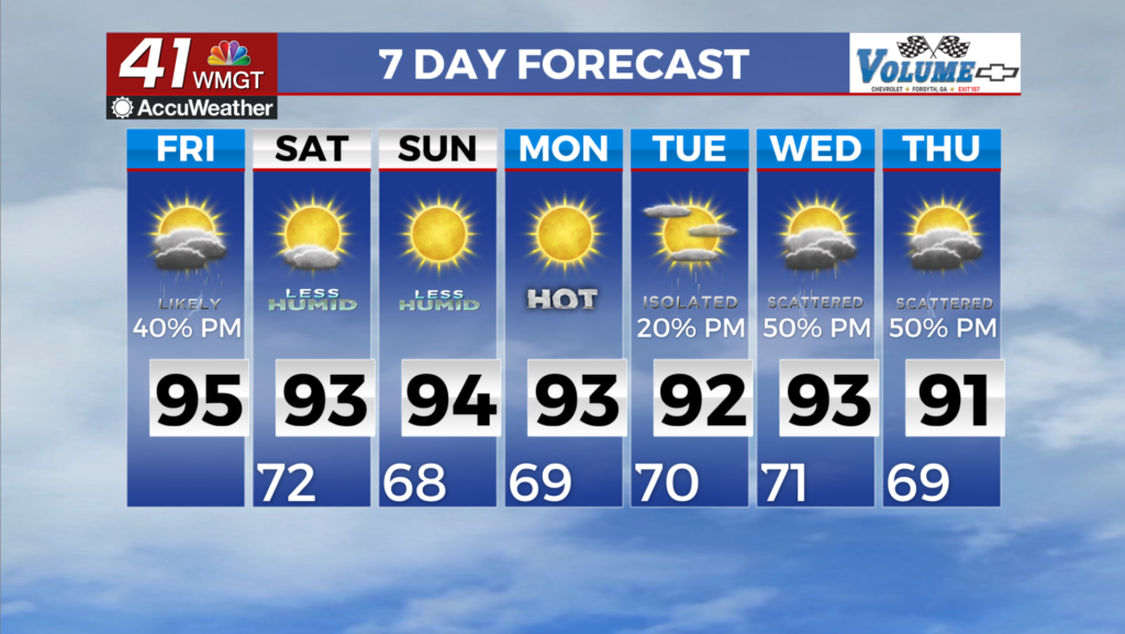
MACON, Georgia (41NBC/WMGT) – For Friday, the area of highest moisture and instability ahead of a frontal boundary will slide south across our area, generally along and south of the I-85 


corridor. With this, we can expect numerous showers and storms developing during the afternoon and evening across that corridor, with drier air and low rain chances to the north. A few storms may be strong to severe across Middle Georgia, with damaging winds as the primary threat, in addition to frequent lightning and locally heavy rainfall. A warm and humid airmass spreading back 


across the area today will allow high temperatures to surge into the mid to upper 90s, with heat index values in the triple digits. Please remember to use caution if you are outdoors exerting yourself, especially during peak afternoon heating. Thankfully, a drier and relatively cooler airmass will start to spread across the area behind a frontal boundary Friday night. As the weekend rolls around and the front clears out. We should be left with a few days of very pleasant weather. Temperatures will remain in the upper 80s and 90s until Wednesday, but relative humidity values in  the afternoon will drop into the mid to low 40s bringing heat index values down and making it feel very dry for this time of year. With this dry airmass behind the front, we’ll also get a break from thunderstorms during the afternoon as well until Wednesday winds become more southerly and we start to pull moisture back in from the Gulf. This weekend and early next week will be a great opportunity to be outside without hating it.