

Heavy rain, gusty winds and isolated tornado threat continue overnight as Sally nears Middle GA
Sally has made herself known in Middle Georgia with heavy rain moving in this evening. Winds have already started to pick up across the area, and we have been monitoring some areas of rotation to our south earlier this afternoon.
So yeah, we are just getting started with this…
Rain and Flash Flooding
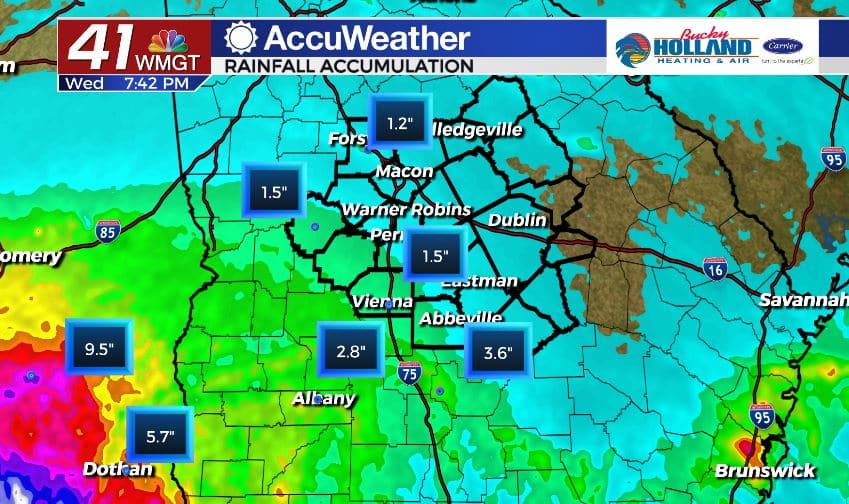
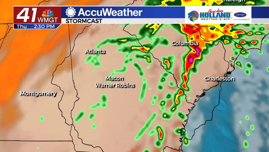
Although we have just started to see rain and storms in the area this afternoon, rain totals are already over 1″ for many of us. Heavy rain has brought an estimated 6-9″ for parts of south Alabama.
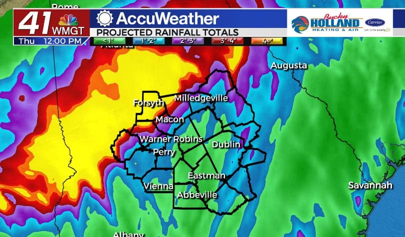
Estimates for Middle Georgia range from an additional 1″ of rain to 7″ so the likelihood is that we will see somewhere in the middle.
Notice, though, on the graphic above that there will be a big drop off and difference between the haves and the have nots as far as rain totals by the time Sally moves out.
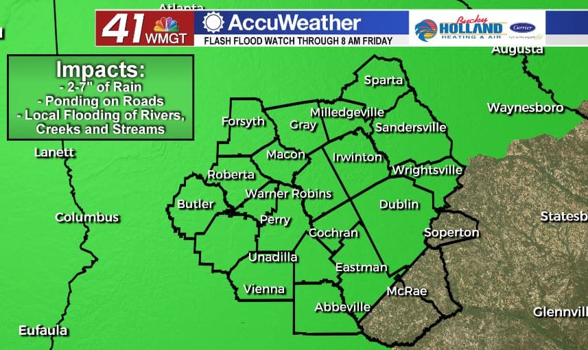
Accordingly, a Flash Flood Watch has been issued for most of Middle Georgia through Friday morning. DO NOT DRIVE OVER FLOODED ROADWAYS! TURN AROUND. DON’T DROWN. Please.
Spin-up Tornadoes
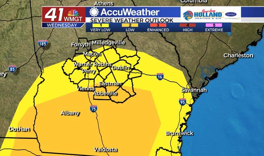
Keeping an eye on the radar today, we have seen a few brief tornadic signatures in some storms to our south. As we move into the rest of the evening our threat for a few tornadoes will increase, especially in the areas in orange on the above graphic.
These can spin up pretty quickly and typically don’t last that long, but stay weather aware tonight and into tomorrow.
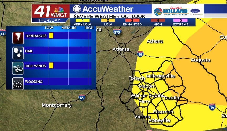
Tomorrow as the main shield of rain from Sally pushes out, we will maintain an small chance of tornadoes, but expect these to be mainly brief spin-ups as well.
Gusty Winds
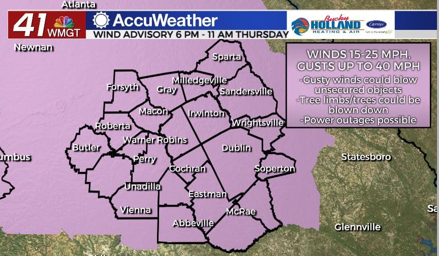
Believe it or not, with this system, winds will be a lesser threat, but still something to take seriously. The combo of heavy rain and just the right amount of wind will bring the possibility of downed trees and power lines.
A Wind Advisory has been issued through 11 am tomorrow.
Timing
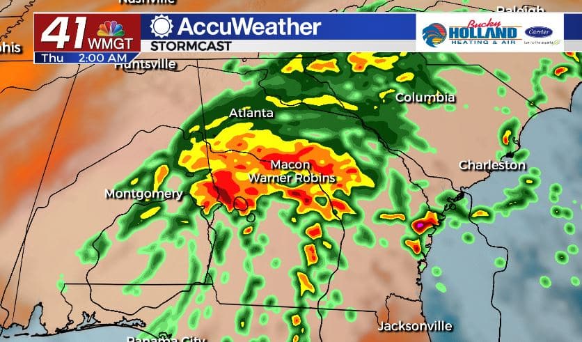
Heavier rain has already started to move into the western fringes of Middle Georgia, but more is on the way overnight. The bulk of the heavy rain will fall overnight. This is good because it means less people on the roads.
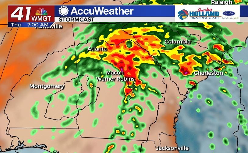
We will likely still be dealing with this tomorrow, but the heaviest rain will shift further to the east. So think mainly east of I-75 as seeing the heaviest rain and best severe chance.
While the central circulation might hang around longer, the main impacts will be pushing east by the afternoon. This will leave some breezy conditions, but severe threat will be done.
As always, find a way to get your warning. *hint hint* The 41NBC Accuweather app is free and will alert you when there is a warning in your area.
Leave a Reply