Storm chances to rise Thursday
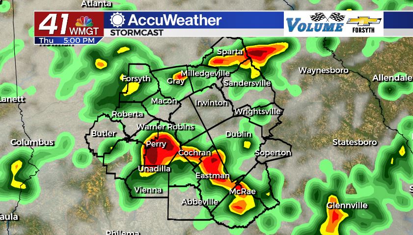
MACON, Georgia (41NBC/WMGT) – Widespread scattered thunderstorms will return to Middle Georgia Thursday afternoon and evening.
This Evening

Mostly cloudy conditions will continue to hang around the Middle Georgia area the rest of the evening. We will see a few isolated thunderstorms, however there should not be as many as there were yesterday. Most of our rain came earlier in the form of widespread stratiform rainfall, especially in our northern counties. Winds for the rest of the evening will come in from the southwest at around 5 mph. Any isolated storms we do see could still bring heavy rain, small hail, and cloud-to-ground lightning.


Tonight skies will also be mostly cloudy, however the odds of overnight rain are rather low. A couple of small showers may occur here or there, but most of us will stay dry. There should be a few small breaks in the clouds to allow for views of the Full Thunder Moon. Ambient wind will come from the south-southwest at around 5 mph. Lows will be in the lower 70s around the region.
Tomorrow


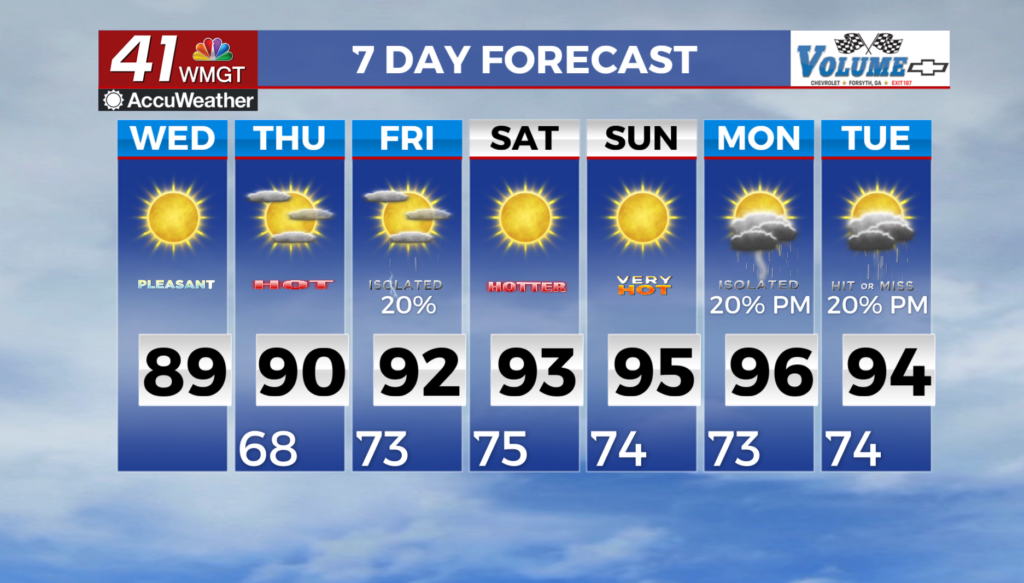
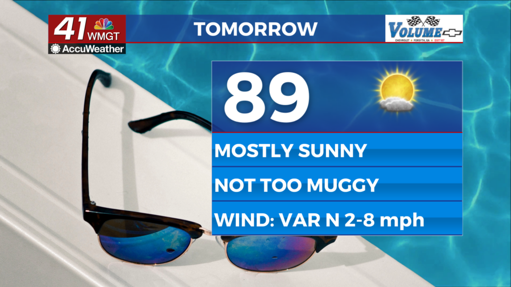
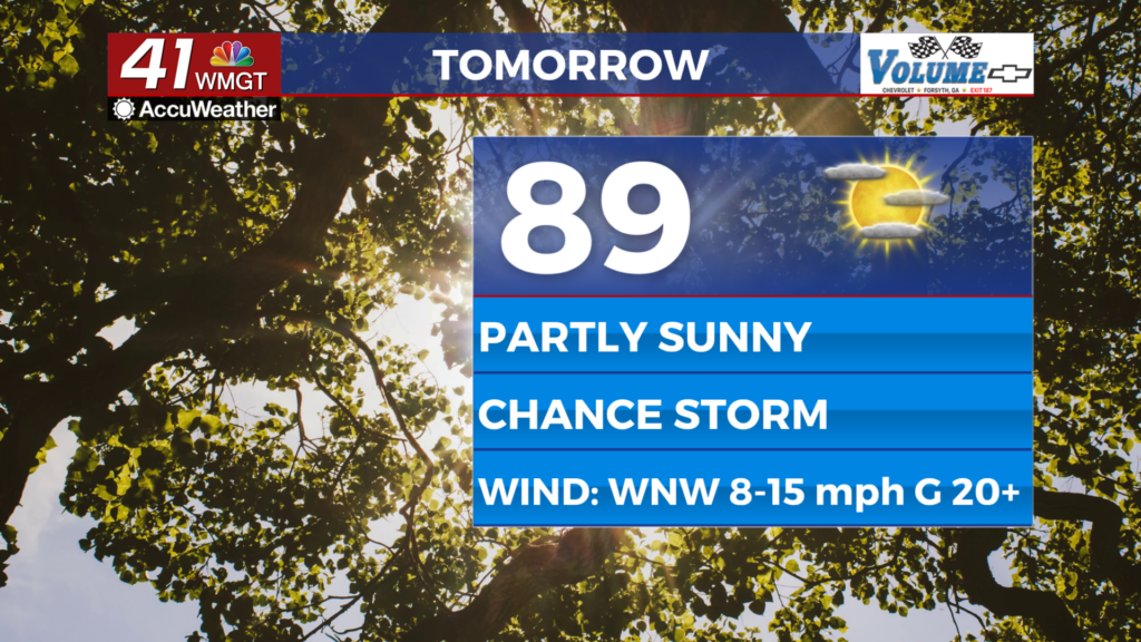
It will be another cloudy one around Middle Georgia tomorrow. The cold front to the north will continue it slow crawl towards us, however once again we will not see the cold front pass through tomorrow afternoon. High temperatures will reach the mid to upper 80s tomorrow. Widespread thunderstorms are likely during the late afternoon and evening hours tomorrow. These will bring heavy rain, frequent cloud-to-ground lightning, and some small to medium sized hail.


Some of the storms tomorrow night will persist into the overnight hours. A few could hang around for much of the night in a couple of select spots. Outside of that skies will be overcast for the rest of the region. Lows will be in the lower 70s across the board.
Friday and the weekend
Friday will continue the cloudy trend as the cold front nears our location. Some models are hinting that we could see some clearing in the afternoon, but at the rate this cold front is moving that is looking more and more unlikely. Highs will still be in the mid to upper 80s Friday afternoon with scattered storms likely during the afternoon and evening. Storms will taper off overnight, and we should see a decent amount of breaking in the clouds. Lows will mainly be in the lower 70s.
Saturday will likely see a large amount of cloud cover return early on with more storms likely in the afternoon, mainly in our southern counties. We should see some breaking in the clouds during the afternoon and evening hours. Temps will push into the upper 80s around the region for the highs, and lows will be in the upper 60s and lower 70s.
Sunday should see a good deal more sun as highs begin to creep back into the 90s in some Middle Georgia locations. Isolated storms will still be possible in the afternoon and evening.

Follow Meteorologist Aaron Lowery on Facebook (Aaron Lowery 41NBC) and Twitter (@ALowWX) for weather updates throughout the day. Also, you can watch his forecasts Monday through Friday on 41NBC News at Daybreak (6-7 a.m.) and 41Today (11 a.m).