Cold front to move through Middle Georgia this evening
MACON, Georgia. (41NBC/WMGT) – A cold front will bring a quick burst of rain to Middle GA later tonight.
Today


The overnight chills returned to Middle GA following a night of very little cloud cover and a brief shift in the winds back to the northwest. Now with the return of daylight the winds will quickly shift to the south thanks to a warm front that will briskly move through the southeastern US. Highs will reach the mid to upper 60s around Middle GA as cloud cover increases more during the afternoon. The rain will likely not arrive until after the sunset save for a couple of isolated showers. The wind will pick up in speed as the day progresses as well, increasing from about 7 mph upwards of 18 mph with gusts close to 25 mph.


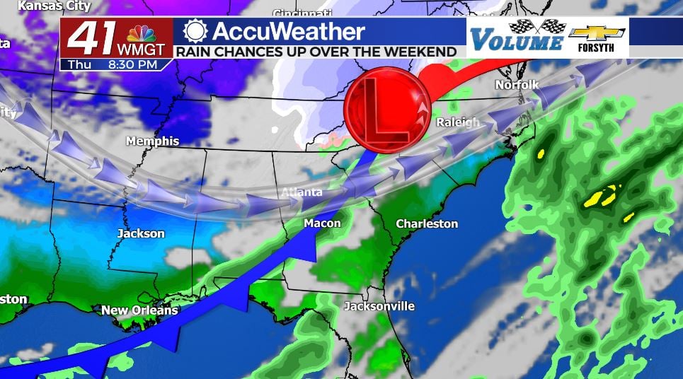
The cold front will arrive shortly after sunset with a line of weak storms. The rain will likely be moderate with a couple of potentially heavy spots. A few rumbles of thunder will be possible, but severe weather is not expected as it is just too cold outside. The rain will likely be over for Middle GA by midnight with the exception of a couple of eastern counties. The wind will then shift to the northwest at 10-15 mph as temperatures drop to around or below freezing heading into Friday morning.
Tomorrow


A few clouds may be left from the weak system around sunrise, but they wont last much past that. Sunny and cool conditions will be back for our Friday around Middle GA as temperatures only climb into the upper 40s and lower 50s. The winds will remain out of the north-northwest at about 5-10 mph, adding a wintry bite to the already cool air. It will also be a bit drier than Thursday, also thanks to the northerly winds.


Friday night will be the coldest so far in 2022 as temperatures fall to sub-freezing levels across the region. Many locations will see lows below 30 degrees. The wind will have only shifted slightly from the daylight hours as well, now blowing from the north-northeast instead of the north-northwest.
The Weekend

Saturday will be a pleasant day as the cool, dry, and sunny conditions hang around. High temperatures will reach the upper 50s and maybe a couple of lower 60s during a sunny afternoon. The wind will predominantly blow out of the east at around 7 mph. More cloud cover will begin to increase overnight ahead of a warm front-cold front combo on Sunday. Overnight lows heading into Sunday morning will be in the upper 30s and lower 40s.

Sunday will see a rapid increase in cloud cover and temperature as a warm front shifts the winds back to the south-southwest. Highs will jump into the upper 60s and lower 70s around the region just ahead of the cold front’s arrival. Showers will begin to fire up in the afternoon hours with widespread rain moving in during the evening. A few rumbles of thunder are possible, but at this time severe weather is not expected. Rain will likely continue through most of the night on Sunday and into Monday morning before clearing out ahead of the sunrise on Monday. Low temperatures Monday morning will be in the mid to upper 40s.

Sunny and cool conditions will return Monday and will hang into the middle of next week.

Follow Meteorologist Aaron Lowery on Facebook (Aaron Lowery 41NBC) and Twitter (@ALowWX) for weather updates throughout the day. Also, you can watch his forecasts Monday through Friday on 41NBC News at Daybreak (6-7 a.m.) and 41Today (11 a.m).


Leave a Reply