More rain on the way as another week comes to a close
MACON, Georgia (41NBC/WMGT) – A low pressure system and its associated fronts will bring rain to Middle Georgia for the opening weekend of August.
This Evening


It’s been a bit hotter today than yesterday however the humidity still is low relative to where it was to begin the week. That will change overnight and into tomorrow as cloud cover moves in with wind shifting directions to out of the southwest after being variable throughout the night. This will ultimately reduce the amount of smoke particulate in the area, however expect the air quality to remain below optimal through this evening and much of tonight. Temperatures will largely valley in the lower 70s however it is not impossible for a location or two to drop below 70. A stray shower is possible however unlikely.
Tomorrow


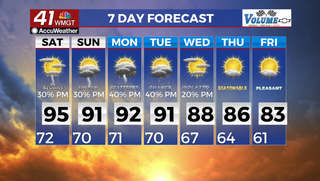
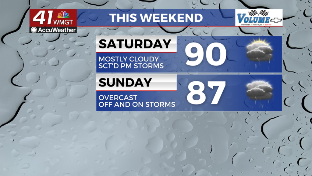
Cloud cover will be dominant by sunrise Saturday however the rain should hold off until later in the day when the warm front arrives from the southwest. This will provide a window for those who work during the weeks to get some lawn care done early. Temperatures will peak in the lower 90s with heat indexes pushing into the upper 90s and low triple digits. Storm activity should begin around lunchtime with peak amounts of rain likely through the suppertime hours. Wind will be a bit breezy from the southwest as gusts may reach as high as 20 mph. Organized severe storms are unlikely however the most intense storms may bring a few damaging wind gusts.


Some rain may persist into the overnight hours however thunderstorm activity will be limited. Temperatures will valley in the lower 70s accompanied by light wind from the southwest around 5 mph. Some fog will be possible leading into Sunday morning as well.
Sunday and Beyond


The cold front will arrive Sunday but likely not until the afternoon. A wave of early morning rain looks likely and it could last into the lunchtime hours. This will impact most if not all of the region. The early rain should keep most high temperatures below 90 degrees Sunday afternoon. When the cold front arrives in the afternoon/evening a few isolated if not scattered storms will be possible. A Level 1 “Marginal” threat for severe storms currently includes basically all of Middle Georgia for Sunday. The primary hazard will be a few damaging wind gusts however some hail cannot be ruled out. These hazards will be possible with the afternoon round of storms.

More scattered activity is likely Monday before rain odds drop and temperatures rebound over the back half of the work week.

Follow Chief Meteorologist Aaron Lowery on Facebook (Aaron Lowery 41NBC) and X (@ALowWX) for weather updates throughout the day. Also, you can watch his forecasts Monday through Friday on 41NBC News at 4, 5, 5:30, 6, and 11 p.m.