


Elevated temperatures and humidity start the first full week of July
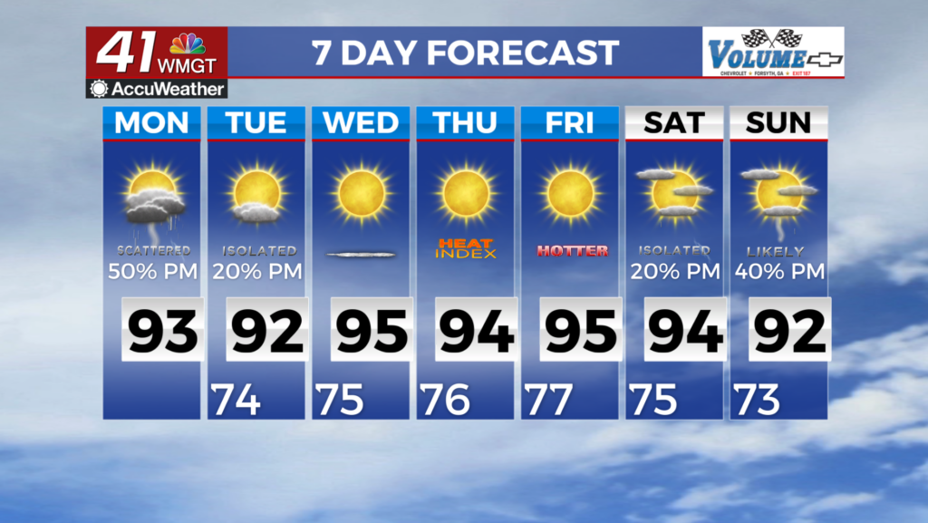
MACON, Georgia (41NBC/WMGT) – Patchy fog in some locations that saw heavy rainfall overnight kickoff the new week. Aside from thunderstorms, heat continues to remain a threat through 


Monday. A Heat Advisory is in effect for southeast portions of the area from 12 PM to 8 PM today. It will remain hot and quite uncomfortable. Summer-like heat and diurnally driven thunderstorm chances will prevail through the rest of the week. Broad troughing continues over the Mid-Atlantic region through the extended period. The upper level ridge remains adjacent to our 


area, but mostly to our south this week. Recent models shows a weak, closed upper level low that sets up just south of the Ohio River Valley and remains anchored there for the first several days of the extended period. This low should eventually be pulled back into the jet stream and the upper level pattern should stay zonal through the rest of the forecast period. Maximum heat index values will still be likely for us this week. The locations most favored to meet or exceed 105 degrees are still across southeast Georgia. Precipitation chances towards the midweek have trended downward due to the new positions of the upper level low. Although the better forcing for thunderstorms has shifted north, isolated thunderstorms are still possible across the area each day as long as convective temperatures are being met. Damaging winds, heavy rainfall, and frequent lightning persist as the main hazards from this pulse-type convection.