Storms likely Saturday as a cold front passes through Middle Georgia
MACON, Georgia (41NBC/WMGT) –
.
This Evening and Tonight


It’s been a mostly cloudy day to end the work week however rain has been hard to come by through the afternoon. A few showers will be possible through the evening however more widespread rain will enter Georgia heading into tonight. This activity is mainly expected to impact northern GA however it could get into parts of Middle Georgia leading up to the sunrise tomorrow. How far south these showers/storms get will be a pretty big determining factor on who will see storms tomorrow afternoon.


Overnight lows will hover around 50 degrees accompanied by wind from the southwest at 5-10 mph with gusts pushing upwards of 20 mph. On a side note there is also the Full “Wolf” Supermoon tonight which will be bigger than normal thanks to the moon being in perigee, or the time of year when the moon is closest to the earth.
Tomorrow


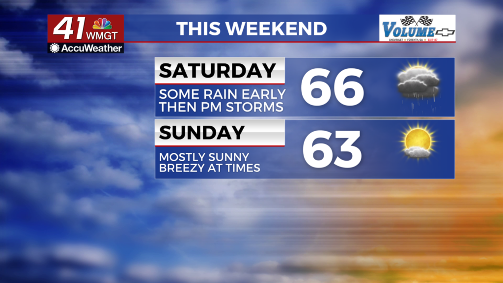
As mentioned above some spots in Middle Georgia may wake up to ongoing rain or perhaps a thunderstorm. This is expected to be the northern reaches of the region however it could end up being a bit further south. It will be key to pay attention to this as those who get the rain overnight/during the sunrise Saturday will be less likely to see thunderstorms in the afternoon. A mostly cloudy day is expected with highs into the mid to upper 60s. The southernmost locations in the region could end up reaching 70 depending on if some sun comes out in the afternoon (this is not what we want to see). Wind will flow from the southwest at 5-15 mph through much of the day with gusts reaching as high as 25 mph (outside of storms).


The Storm Prediction Center currently has most of Middle Georgia included in a Level 1 “Marginal” threat for tomorrow. If a Level 2 “Slight” threat is to be added it will likely include a few of the southern counties within the region. The primary threat looks to be some damaging straight line wind gusts, however a spin-up tornado or some hail cannot be ruled out. As mentioned above, the further south the overnight rain reaches the less of the region will have to deal with those threats.


The rain should clear out during the sunset hours leading to partly cloudy skies overnight. The wind will be northwesterly initially however the prevailing direction overnight will mainly be out of the north at around 5 mph. Gusts may still push to 15-20 mph, however. Overnight lows should drop into the low to mid 40s leading into Sunday morning.
Sunday and Beyond


Sunnier conditions will be back on Sunday with highs in the low to mid 60s. The coldest night following Saturday’s cold front will be Sunday night with lows likely to drop just below 40 degrees. It will be mild to start the new work week with unseasonable warmth likely as it progresses.

Follow Chief Meteorologist Aaron Lowery on Facebook (Aaron Lowery 41NBC) and X (@ALowWX) for weather updates throughout the day. Also, you can watch his forecasts Monday through Friday on 41NBC News at 4, 5, 5:30, 6, and 11 p.m.


