Cloud cover arrives tonight ahead of showers tomorrow
MACON, Georgia (41NBC/WMGT) – High clouds will move in after midnight tonight ahead of a warm front/cold front combo that will bring showers Friday and possibly storms Saturday.
This Evening


Skies will largely remain clear heading into tonight, however a bit ahead of midnight some cirrus clouds will begin to move in from the west. These will thicken up some by sunrise tomorrow but could make for some pretty starts to the final day of the week. The wind overnight will flow from the southwest at 5-10 mph with gusts reaching to around 15 mph. No rain is expected. Temperatures will reach their valleys in the upper 30s and lower 40s.
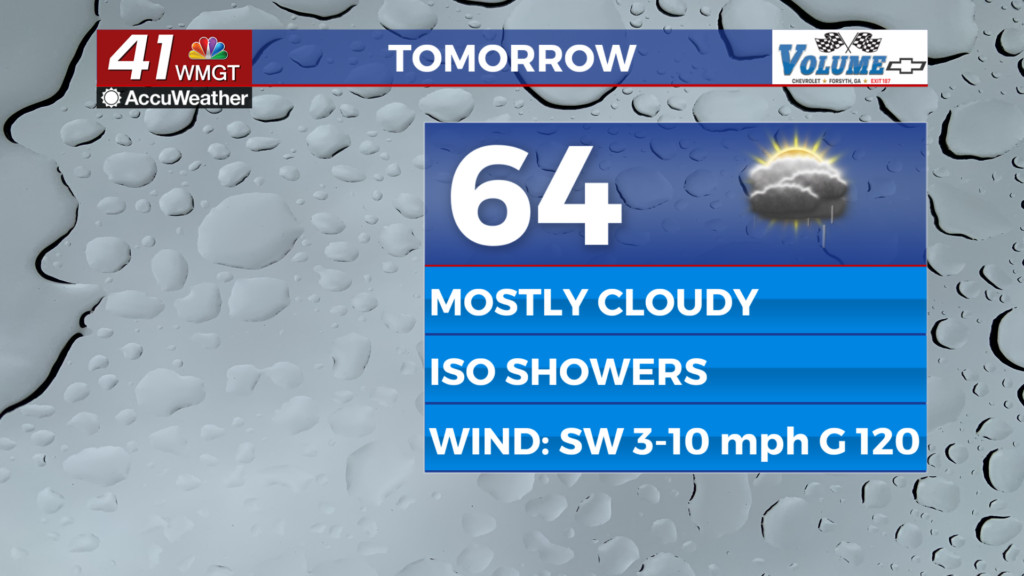
Tomorrow


A mostly cloudy day is expected to end the work week with any sun likely limited to the first half of the morning. Heading into lunchtime and later a few isolated showers will be possible, and these may linger into the evening. High temperatures will reach the mid to upper 60s around the region accompanied by wind from the southwest at 5-10 mph gusting to around 20 mph.


Overnight will remain cloudy which will make viewing the Full Wolf Moon (expected to be a Supermoon as it lines up with Perigee, the time of year that the Moon is closest to the Earth) rather difficult if not impossible. Some showers will be possible, however some stratiform rain could be possible as Saturday begins. Low temperatures will hover around 50 degrees ahead of the sunrise on Saturday. Fog will also be possible through the overnight hours as the wind should slow a bit, staying out of the southwest.
This Weekend


It’s a split forecast for the weekend with Saturday likely to be mostly cloudy (if it rains to start the day this could keep things overcast and a bit cooler) with highs into the upper 60s and possibly lower 70s. An incoming cold front will move into Middle Georgia sometime during the day with earlier being better in hopes to avoid severe weather threats.


The Storm Prediction Center currently includes almost all of Middle Georgia in a Level 1 “Marginal” threat Saturday afternoon. The primary threat will be damaging wind gusts however it does appear all hazards could be possible to some degree. A later cold front arrival will open more severe possibilities around the region, and this could further increase if there is not stratiform rain to help stabilize the atmosphere during the sunrise hours Saturday morning.

Sunday on the other hand will be mostly sunny and a bit cooler with highs reaching the lower 60s accompanied by wind out of the north at 5-10 mph. It could get gusty at times Sunday afternoon on the backside of the aforementioned cold front, however no major temperature drop is expected with this front. No nights over the next 7 days are expected to get down to freezing and by the middle of next week temperatures may return into the 70s.

Follow Chief Meteorologist Aaron Lowery on Facebook (Aaron Lowery 41NBC) and X (@ALowWX) for weather updates throughout the day. Also, you can watch his forecasts Monday through Friday on 41NBC News at 4, 5, 5:30, 6, and 11 p.m.