
Hot temperatures and high indices stick around
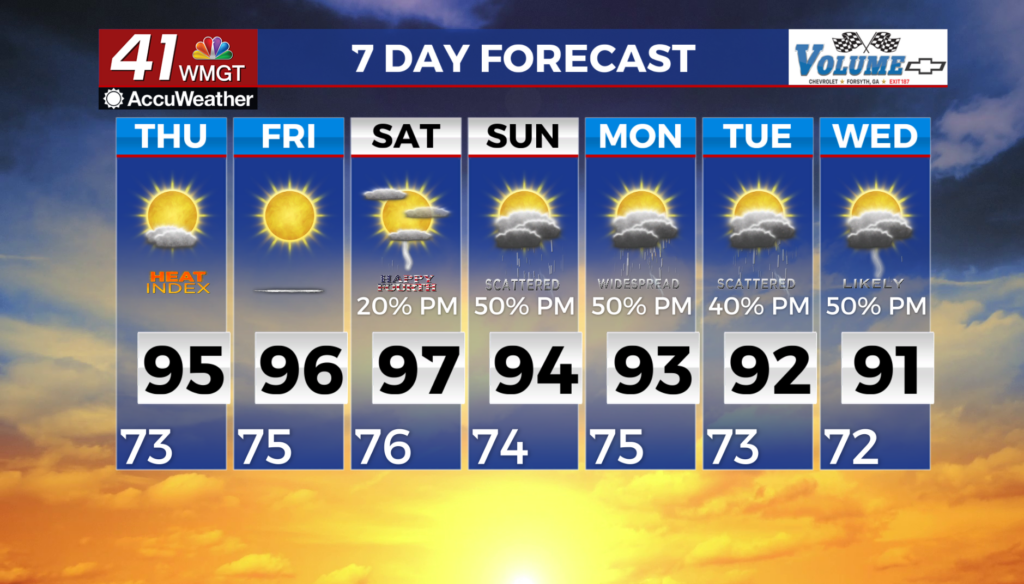
MACON, Georgia (41NBC/WMGT) – A high pressure pattern persists over the Southeast through the short term period, with very little movement in the broad ridge in the upper levels of the 


atmosphere as it closes off and develops into a midlevel anticyclone. The influence of this feature will keep hot conditions in place across Middle Georgia. Low temperatures will start the morning in the mid 70s across the majority of the area, with some upper 70s in portions of North Georgia. These low temperatures are around 4 to 8 degrees above normal in Middle Georgia. Dewpoints 


across much of the area are in the mid 70s. If you plan to spend time outdoors, please take the necessary precautions, drink plenty of fluids, and take frequent breaks in the shade and air conditioning. Surface winds from the northeast will usher in drier air into central and portions of east Georgia, with dewpoints dropping into the mid to upper 60s. This decrease in dewpoints is 

expected to be enough to keep heat indices below critical thresholds in these areas. Scattered thunderstorms could develop this evening in areas northwest of Atlanta. A few of these storms could be strong being favorable for microbursts and damaging wind gusts. A similar setup is expected on Thursday, with comparatively drier air limiting heat indices and chances for precipitation in Middle Georgia.