
Wind picks up as temperatures drop Thursday
MACON, Georgia (41NBC/WMGT) – The cold front responsible for storms Wednesday afternoon and evening will bring cooler temperatures and plenty of wind.
This Evening
Isolated showers and storms will remain possible through the evening and into tonight. Cloud cover will remain dominant and conditions will stay muggy. Wind will pick up after midnight as it shifts to out of the northeast with gusts likely pushing towards 20 mph by sunrise tomorrow. Expect lows in the low to mid 60s across the region.
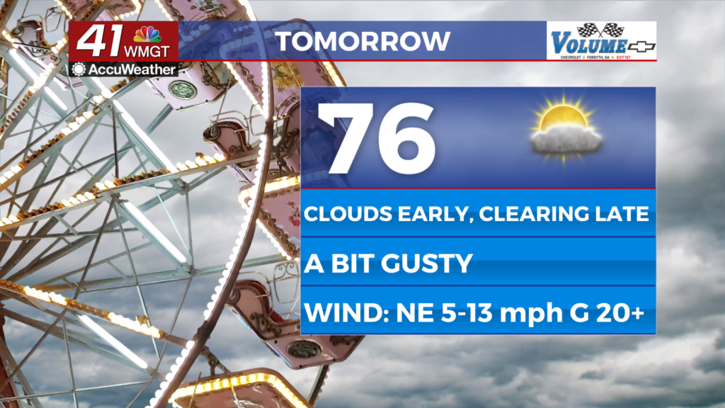
Tomorrow
Plenty of clouds will still be around through much of the day tomorrow however more sun is likely during the late afternoon and evening. Highs will reach the low to mid 70s accompanied by wind from the northeast at 5-15 mph with gusts pushing as high as 25 mph. A stray shower or two will be possible through the afternoon.


Overnight will be mostly clear as strong breezes persist from the northeast. Gusts will likely still push towards 20 mph. Lows will be in the mid to upper 50s, or around the average for this time of year.
Friday and Beyond
Mostly sunny conditions are likely Friday and Saturday as highs will stay in the 70s both days. Both Friday and Saturday will also be pretty windy. Sunday will see calmer winds as highs return to the lower 80s in parts of the region.
The Tropics
Jerry is still churning in the Atlantic and is expected to remain out to sea. The area of interest west of the Yucatán still has 10% odds to develop over the next 7 days but is likely not of concern to the US. Heading into the weekend, however, a low pressure system is expected to develop offshore of GA/SC and then start moving north. This will be a driving factor for the stronger winds that will last through Saturday.

Follow Chief Meteorologist Aaron Lowery on Facebook (Aaron Lowery 41NBC) and X (@ALowWX) for weather updates throughout the day. Also, you can watch his forecasts Monday through Friday on 41NBC News at 4, 5, 5:30, 6, and 11 p.m.