Wednesday to bring the hottest temperatures of the week
MACON, Georgia (41NBC/WMGT) – Temperatures will push towards the mid 90s Wednesday afternoon around Middle Georgia.
This Evening


It’s been another mostly sunny day around Middle Georgia with temperatures that largely peaked in the lower 90s. Heading into tonight, however, clouds will not completely clear out. Several high clouds will likely remain overhead and into tomorrow. Low temperatures will be in the mid to upper 60s accompanied by light wind from the south-southeast. Fog will again be possible ahead of the sunrise Wednesday.
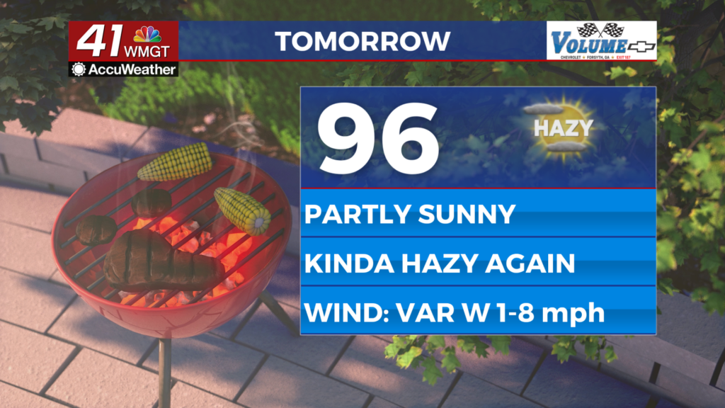
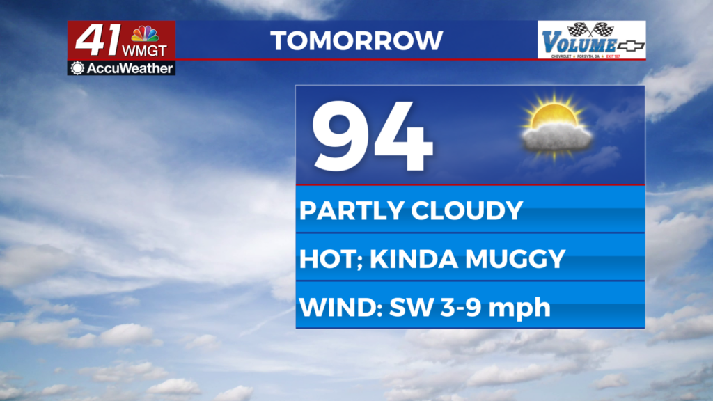
Tomorrow


Wednesday is likely to be partly cloudy and hot with highs that push into the mid 90s and real feels the upper 90s. Wind will be light from the southwest at around 5 mph. A stray shower or storm will be possible in the afternoon or evening however most of the region will stay dry.


Overnight cloud cover is likely to increase some leading up to Thursday morning. While north Georgia will get some rain courtesy of the incoming cold front that activity should largely stay out of the region. The northwestern-most counties may get a shower or two.
Thursday and Beyond


The aforementioned cold front will bring storms to Middle Georgia starting Thursday afternoon. As of now a Level 1 “Marginal” threat for severe weather includes all of Middle Georgia for Thursday. The front will drop temperatures from the low to mid 90s down to the lower 80s by Friday afternoon. More storms will also be possible around the region Friday as the front stalls out.
The Tropics


Two areas continue to bear watching in the Western Atlantic Ocean. Invest 93L has 90% odds to develop into a Depression and Invest94L has 60% odds to become a depression. Invest94L has better odds to bring some sort of impact to The Peach State, however the aforementioned cold front will likely end up steering these disturbances back out to sea.

Follow Chief Meteorologist Aaron Lowery on Facebook (Aaron Lowery 41NBC) and X (@ALowWX) for weather updates throughout the day. Also, you can watch his forecasts Monday through Friday on 41NBC News at 4, 5, 5:30, 6, and 11 p.m.