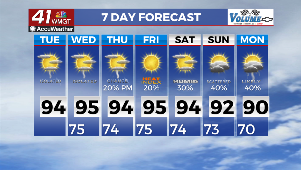
A bit more sun likely Thursday as rain odds persist
MACON, Georgia (41NBC/WMGT) – Temperatures should largely return to the 90s as scattered storms will be possible again Thursday afternoon.
This Evening


A mostly cloudy day will stay that way through most of the evening before some clearing happens during the overnight hours. Scattered showers and storms will continue through the suppertime hours before tapering off into the night. Severe weather is not expected. Lows will be in the low to mid 70s accompanied by light wind from the east around 5 mph.
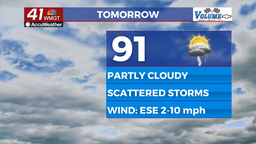
Tomorrow


A relatively clear start is expected to Thursday before clouds gradually fill in through lunchtime and into the afternoon. Around half the region or so should see showers or storms as a weak low pressure remains in the area but drifts west. Highs will largely be in the low to mid 90s with heat indexes pushing 100.


Overnight will be mostly clear with lows largely in the lower 70s. Wind will flow gently from the south-southeast and some fog will be possible ahead of sunrise Friday morning.
Friday and Beyond


Storm odds will drop further Friday as more sun than clouds is expected. Temperatures should be back into the mid to upper 90s by Friday afternoon as well with more heating expected into the weekend. Plenty of sunshine is likely both Saturday and Sunday with rain odds taking a seat on the back burner.
Watching the Tropics

The low pressure responsible for the clouds Middle Georgia is seeing today is expected to move over the Gulf in the next few days. Odds for development currently are 10% over the next 7 days, however it will be something to watch going forwards.

Follow Chief Meteorologist Aaron Lowery on Facebook (Aaron Lowery 41NBC) and Twitter (@ALowWX) for weather updates throughout the day. Also, you can watch his forecasts Monday through Friday on 41NBC News at 4, 5, 5:30, 6, and 11 p.m.