


Hazy, hot and humid is the summertime song for Middle Georgia
MACON, Georgia (41NBC/WMGT) – We are in the thick of summer as temperatures continue to trend at or slightly above average. A warm and humid airmass remains in place across North 


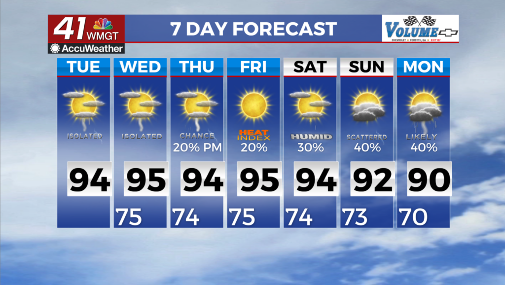
and Middle Georgia through the forecast period with heat and a slight chance for thunderstorms as the primary weather concern. Today will favor similar temperatures in the mid 80s north of I-85 and the mid 90s further south. A little bit more drier air starts to work its way through the area by Tuesday morning. Better support aloft moves out of the area and the surface low/front moves northeast. As a result, storm coverage will trend down overall with only isolated to widely scattered showers and storms expected mainly after 2 PM. Impactful temperatures based off heat indices will continue, at least through the end of the week. Low to medium possibilities for precipitation will also prevail across the region for the next several days. An upper level low remains centered 

between the mid-Mississippi and Ohio River Valleys at the start of the period, but will transition northeastward towards the end of the week. By then, zonal (west to east) flow will only last for a few days before a strong upper level trough moves through the Southeast at the end of the period. Given how the models are, positioning and timing of this pattern change will be monitored as fine tuning details are resolved. In the meantime, hot summertime high temperatures persist across the region. I would not be surprised if heat advisories are issued again for our Southeast friends where heat indices of 105 degrees could be met. Temperatures could finally decrease next week if models hold; this will depend on frontal strength and positioning which is too far out to determine accurately. Weak upper level forcing in conjunction with diurnal heating continue to be the driving mechanism for thunderstorm development for the coming days. Slight chances for precipitation are still present across much of the coverage area due to our favorable amounts of moisture present. Most of the convection will be isolated most days for the remainder of the week.