Temperatures to reach their weekly peaks Thursday
MACON, Georgia (41NBC/WMGT) – For the first time this week temperatures will climb above the seasonal average ahead of a slow moving cold front.
This Evening


A sunny start to the day has seen clouds fill in throughout the afternoon. It was not nearly as bitter of a day outdoors as temperatures climbed into the upper 50s and lower 60s. Overnight cloud cover will thicken more and a couple of rain showers will be possible. It will also be a much warmer night than the past few as lows will remain above freezing. Wind will be light and variable.
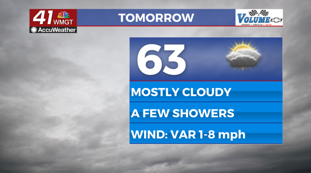
Tomorrow


Skies will be mostly cloudy throughout the day on Thursday however that will not stop temperatures from warming into the mid 60s for many. A few spots could possibly eclipse 70. The wind will generally be variable from the south. Rain showers will be limited however one or two during the afternoon will be possible.


Overnight will be mostly cloudy with a few showers possible once again. This should be the warmest night of the week with lows likely in the mid 40s for most around Middle GA. The wind will flow from the northeast around 5 mph.
Friday and This Weekend


The aforementioned cold front will finally arrive on Friday bringing rain showers with it. Expect the showers to be off and on throughout the afternoon and evening, continuing through much of Saturday.


When it comes to the winter weather potential several models are suggesting more of the ice will remain north of the region (resulting in mainly rain here), however the GFS stands firm on an ice storm for Middle Georgia. These discrepancies will work themselves out over the next few days. Shown above are potential icing numbers. Radial Icing is ice that accumulates around power lines/tree branches. Flat icing is ice that accumulates on flat surfaces (roads, railings, etc.). Radial icing accumulations are typically around 40% of flat icing accumulations. Radial icing of a quarter inch or more (around an inch of flat icing) will lead to downed power lines and tree branches.
In the meantime it wouldn’t be a bad idea for Middle Georgians to prepare by getting non-perishable food items/food you don’t need to cook and water. High level ice storms can cause extended power outages and make travel near impossible, so it is essential folk prepare in the event these things occur. Extremely cold weather looks possible early next week as well once the system has passed.

Follow Chief Meteorologist Aaron Lowery on Facebook (Aaron Lowery 41NBC) and X (@ALowWX) for weather updates throughout the day. Also, you can watch his forecasts Monday through Friday on 41NBC News at 4, 5, 5:30, 6, and 11 p.m.