Slow moving cold front to bring several rounds of storms this weekend
MACON, Georgia (41NBC/WMGT) – A slow moving cold front likely to become stationary over Georgia will bring storms throughout the weekend and into next week.
This Evening
A partly sunny afternoon will see a few storms creep in from the north this evening, however a good chunk of the region likely will see no rain. The odds remain highest in the northeastern counties. Overnight will be muggy and partly cloudy with temperatures expected to valley in the low to mid 70s. Some patchy fog will be possible overnight and into tomorrow, especially for areas that get rain this evening. The wind will remain light from the southwest.
Tomorrow
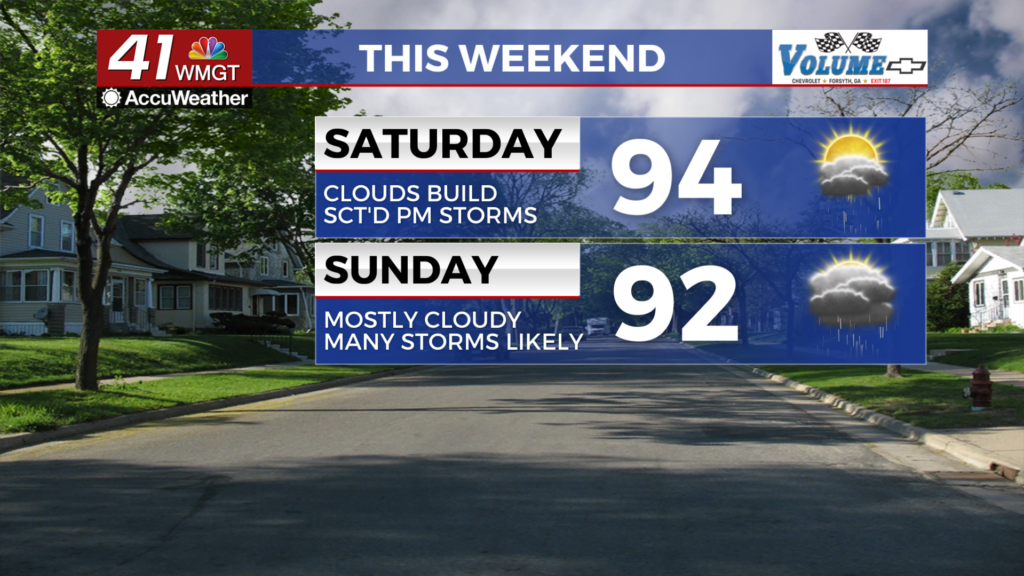
Saturday should see a decent amount of sunshine to start as temperatures rise into the mid 90s for most of the region. Heat indexes will again eclipse 100 for most of the region. The wind will flow from the west-northwest at 5-10 mph with gusts pushing to around 15 mph.


In the late afternoon the cloud cover will increase as storms begin to move in from the north. A Level 1 “Marginal” threat for severe storms includes the majority of Middle Georgia. The main risks will be a few damaging wind gusts or some hail.


Overnight a few storms will stick around as temperatures drop into the lower 70s for most of the region. The wind will flow out of the west around 5 mph. Fog is likely heading into the start of Sunday around the region as well.
Sunday and Beyond
With the cold front likely stuck over Middle Georgia come Sunday the odds for rain will climb even higher. This time the entire region is included in a Level 1 “Marginal” risk for severe storms. The hazard are the same as above, however the amount of storms is likely to be higher thus the overall risk will likely be slightly higher as well.

Heading into the new work week the wet pattern will continue with high temperatures likely to remain below 90 the first couple of days next week thanks to the slow moving front pushing a bit more south. By late next week temperatures should rebound to near average for mid-late July.

Follow Chief Meteorologist Aaron Lowery on Facebook (Aaron Lowery 41NBC) and X (@ALowWX) for weather updates throughout the day. Also, you can watch his forecasts Monday through Friday on 41NBC News at 4, 5, 5:30, 6, and 11 p.m.