
Significant impacts expected from Isaias on Saturday
MACON, Georgia (41NBC/WMGT) – Calm weather is expected to continue through the first part of Friday for much of the area before Isaias leads to a drastic change in weather conditions this 


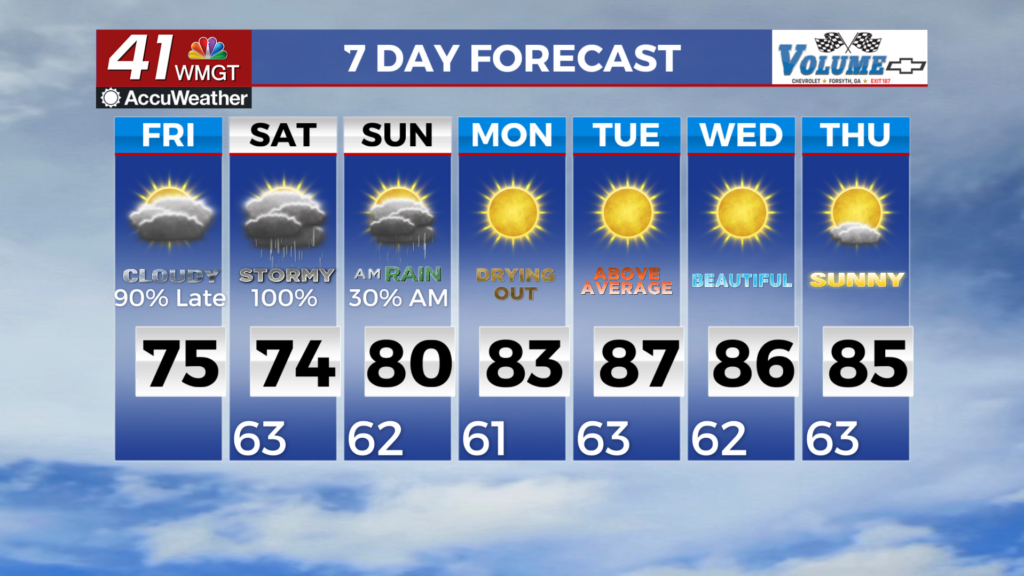
weekend. Through early Friday we will see overall high pressure over the area with mostly light and variable winds. Temperatures will continue to rise with highs in the mid to upper 80s on Friday which are 10 to 12 degrees above normal. Lows will be in the upper 50s to low 60s on Saturday morning. Thick high level cirrus clouds will continue to filter into the area as hurricane Isaias continues to track northward. From Friday night through Sunday, Hurricane Isaias will make landfall over the Gulf Coast and then weaken as it moves northward across Mississippi and Alabama into the Tennessee Valley. North and Middle Georgia will be on the dirty side or the right side of the storm, and potentially see significant impacts with a prolonged period of strong winds, heavy rainfall with localized flash flooding, and a few tornadoes. As Isaias moves inland Friday night into Saturday, its wind field will expand considerably, with strong winds extending well east of the 


center of the storm into West-Middle Georgia. A Tropical Storm Watch is in effect for this area where wind gusts of 40 to 50 mph will be possible which includes Upson, Taylor and Macon counties. Further north and east, while Isaias is weakening and becoming post-tropical, there will be a very strong pressure gradient between it and high pressure over the Mid-Atlantic. This gradient supports a prolonged period of strong easterly winds with frequent gusts to 40 to 50 mph across most of North Georgia from early Saturday through early Sunday. A High Wind Watch has been issued for this area. The prolonged and strong winds could lead to numerous power outages from downed limbs and trees, especially when combined with saturated soils from periods of 


heavy rain. As the system moves north, it will bring widespread rainfall and multiple bands of heavy rain across the area Friday night through Sunday. Rainfall totals of 1 to 3 inches are likely across most of the area, with localized amounts up to 5 inches possible. This could lead to flash flooding, particularly in urban and poor drainage areas, as well as flood-prone creeks and streams. A Flood Watch has been issued for the entire area. Also, this is a favorable environment for tornadoes and possible development could occur across North and Middle Georgia, potentially lingering into Sunday morning. Several tornadoes will be possible during this period, including the overnight hours Saturday night. Tornadoes from tropical systems are typically quick to develop and are short-lived, but with the forward speed of this system and the unique set-up, we can’t rule out a stronger EF2 or EF3, long-track tornado. It is imperative that everyone has a way to receive tornado warnings! On the backside of Isaias remnants, a ridge builds over the Southeast U.S., bringing a warm and dry airmass into the area. Rain chances drop to zero for Monday through Wednesday, with low temperatures in the upper 50s to low 60s, and high temps in the low to mid 80s.