
Rain odds for Halloweekend dropping
MACON, Georgia (41NBC/WMGT) – While cloud cover and humidity will continue to increase leading into the weekend the odds for rain seem to be on the decline.
This Evening
A partly cloudy afternoon will become a partly cloudy night around Middle Georgia with temperatures likely to valley in the mid 50s around the region. The wind will remain light out of the northeast. A bit of fog may be possible around sunrise Friday morning.
Tomorrow
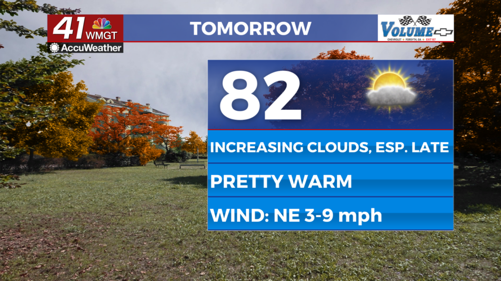
A good amount of sunshine is likely over the first half of the day on Friday before more clouds (especially upper level) move in during the late afternoon and evening across the region. Temperatures will largely peak in the lower 80s accompanied by a northeast wind at 5-10 mph.


Overnight will be mostly cloudy with a slim chance for a small shower, however the odds for rain are very slim. The wind will flow more from the east-northeast around 5 mph through the overnight hours. Once again some fog will be possible to begin Halloween.
Halloweekend and Beyond
While the rain odds seem to be dropping for this coming weekend that doesn’t mean they are going away. The chance for impacts to trick-or-treat remain slim to none as heavier rain should hold off until Sunday. However it is now looking less likely that everyone around Middle Georgia will see rain on Sunday with the odds dropping closer to 50% vs 100%. Clouds are still expected to stick around into next week while rain odds will be limited to a small shower or two.
Aside from rain this weekend expect cloudy conditions with highs on Halloween in the upper 70s and lower 80s and highs on Sunday in the mid-upper 70s (could be cooler if rain moves in earlier/is more widespread). Don’t forget as well to set your clocks back before Sunday as Daylight Saving time comes to and end!

Follow Chief Meteorologist Aaron Lowery on Facebook (Aaron Lowery 41NBC) and X (@ALowWX) for weather updates throughout the day. Also, you can watch his forecasts Monday through Friday on 41NBC News at 4, 5, 5:30, 6, and 11 p.m.