
High heat and humidity kick off the weekend
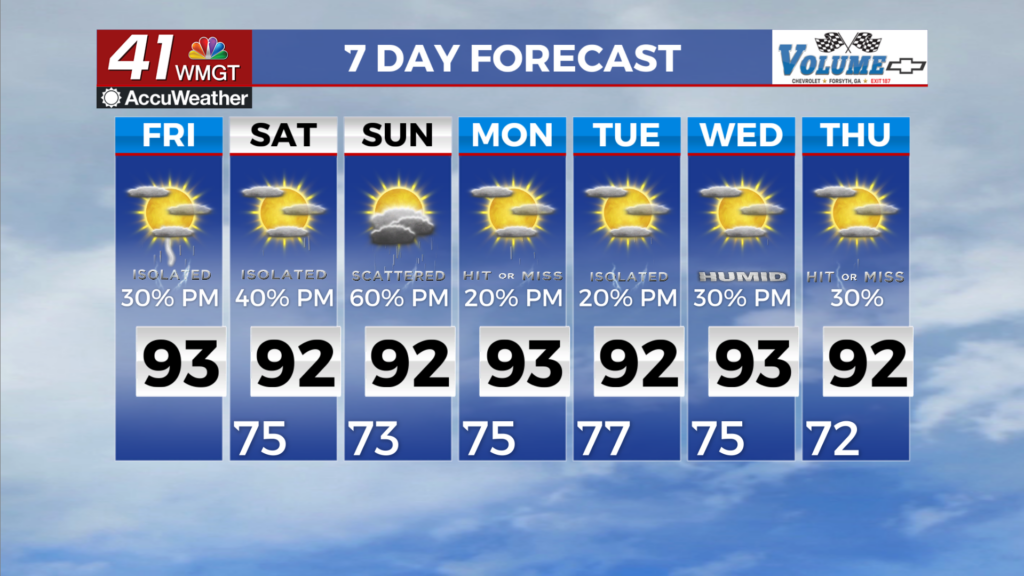
MACON, Georgia (41NBC/WMGT) – Hot and humid conditions (typical for mid-July) continues today, with highs in the upper 80s to low 90s and heat index values in the upper 90s to low 100s. 


Slightly higher dewpoints will move in on Friday, bringing peak heat index values above 100 across most of the region. A Heat Advisory is in effect until 8 PM Friday for parts of eastern Georgia where heat index values may exceed 105 degrees. Winds will be out of the northwest around 7 to 10 mph with gusts of 15 to 20 mph, which will try its hardest to make the heat less brutal. As the extended period begins on Saturday morning, a weak low over the northwestern Gulf meanders towards the Florida peninsula. Meanwhile, an upper level trough moving across the Great Lakes 


will extend southward through the Ohio Valley region, continuing eastward towards the Atlantic coast. A warm and humid airmass remains in place between these two features, with low temperatures and dewpoints on Saturday starting off in the mid 70s across the majority of the area. High temperatures will be near to just above seasonal levels, ranging from the upper 80s in far north Georgia to the mid 90s in areas south I-85. Heat index values are also forecast to rise to over 100 across the majority of the state, excluding the far northern tier. Locations in east- Middle 
Georgia could furthermore exceed 105. With little change in the airmass north and central Georgia, temperatures and dewpoints will be similar on Sunday. Scattered to numerous showers and thunderstorms are expected across the area on Saturday and Sunday, with highest chances during the afternoon with diurnal enhancement. Guidance also indicates the development of surface troughing to the east of the Appalachians by late Saturday afternoon and into Sunday. The presence of this trough and ample instability could favor the formation of organized clusters of storms. A cold front stretching across Kentucky could further more storms for Sunday, which could also become organized as they drop towards North Georgia within the northwesterly flow. In both cases, these storms could produce strong wind gusts in addition to the requisite heavy rain and frequent lightning that come with summertime storms.