Daily chances for rain and thunderstorms return this week
MACON, Georgia (41NBC/WMGT) – Moist summertime conditions have returned to Middle Georgia. Southerly flow has driven moisture levels up significantly. Cloud cover covers the western 


portion of the state and radar is picking up rain along the western counties. The heaviest rainfall is over northern Alabama and South Middle Tennessee, where significant training has occurred resulting in flash flooding. We expect a strong moisture transport from the Gulf into northwestern portions of our coverage area. This could lead to training heavy rainfall for us. The main thing to watch for over the coming hours is how this axis of heavy rainfall shifts eastward. There is the potential for this axis to slowly move into North Georgia and could pose a flash flood threat over


the coming hours. Taking a look at the upper level flow, ridging over the eastern region has begun to be undercut by the ejecting southwest midlevel trough. As the feature moves across the south (currently over Texas and Oklahoma), expect increasing showers and thunderstorms out ahead as the ridge is weakened. Moisture levels are expected to continue climbing as the system approaches. Given the poor upper level steering through the coming days, any thunderstorms that do form may be slow moving, training efficient rain makers, and will pose a flash flood threat. 

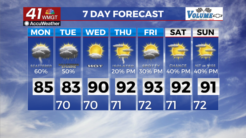
The mean storm mode through the next couple of days, as the system passes, we will see showers spreading over North Georgia today. Precipitation will taper overnight as diurnal instability weakens, before seeing further surges going into Tuesday afternoon along side diurnal heating. Lightning will be spotty within the showers. Temperatures through the period will be moderated by cloud cover and rainfall. Highs today through Tuesday will be around 80 with lows holding in the upper 60s to near 70.