
Crisp Fall temperatures finally reach Middle Georgia this weekend
MACON, Georgia (41NBC/WMGT) – The main story for the weekend will be a sharp cold front pushing through North and Middle Georgia later today bringing highly anticipated 


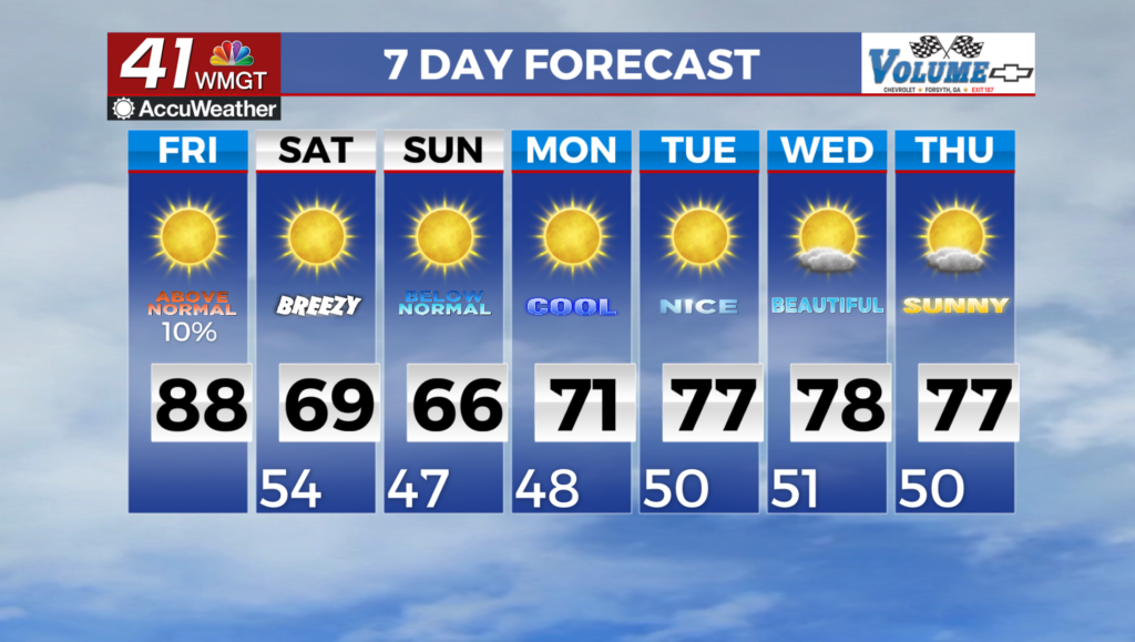
Fall temperatures to the region. High pressure slides off the Mid-Atlantic as a deepening shortwave ushers in a mostly dry cold front by Friday afternoon for Northwest Georgia. The latest guidance is not thrilled about any precipitation accompanying this front, and this will message a very low possibility (less than 10% chance) of an isolated shower or some sprinkles Friday afternoon. It will be breezy with gusts of 20 to 30 mph during the afternoon and evening on Friday. Although the highest gusts look to be at the highest elevations in Northeast Georgia, hold on to your hats, temperatures fall into the 40s and 50s by Friday night/early Saturday. The continued elevated winds during this time should inhibit any frost 

potential. The axis of a deep mid-level trough and associated sharp cold front will be quickly advancing through the state as the extended period begins, which will clear the area to the southeast by mid-morning on Saturday. This cold front will be dry, with rain chances of 10 percent in portions of far north and east Georgia. There will be a strong pressure gradient in place behind the front and ahead of the surface high. The pressure gradient will contribute to breezy northwesterly winds between 15-20 mph with gusts up to 30 mph through much of the day on Saturday. A significantly cooler airmass will also set up over the region in the wake of the front. Low temperatures on Saturday morning are expected to be in the mid to upper 40s in areas north of I-85 and in the low to mid 50s to the south. As cooler air becomes more established, afternoon highs will range from near 60 in the far northern tier to the low 70s in South-Middle Georgia. Strong radiational cooling under clear skies will lead to the coolest temperatures of the season early Sunday morning, with widespread 40s and even some mid to upper 30s in the higher elevations of far Northeast Georgia. A gradual warming trend begins next week as another surface high moves into the west Atlantic as the previously mentioned ridge becomes centered over the Southeast and Mid-Atlantic coast.