Clouds and rain chances climb again starting Tuesday
MACON, Georgia (41NBC/WMGT) – A new pattern that will bring several rain chances is taking over Georgia starting Tuesday.
This Evening


A sunny evening will lead to a clear night initially, however cloud cover will increase through the overnight hours. The wind will be light as it shifts more out of the southeast. Temperatures will valley in the mid to upper 50s across the region. No rain is expected overnight tonight.
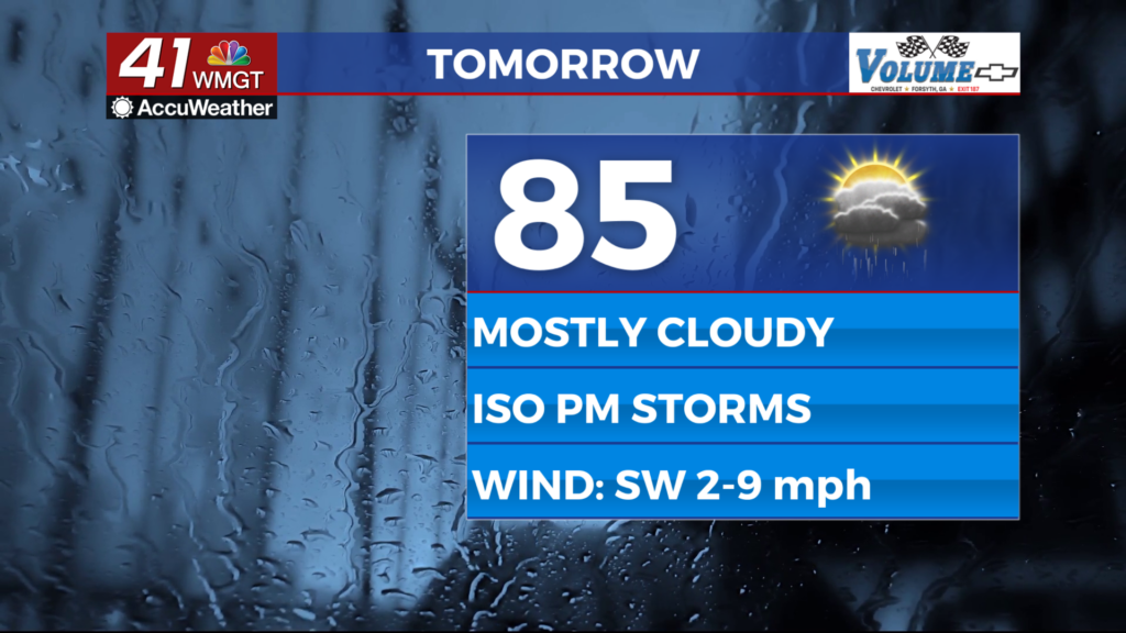
Tomorrow


A lot more cloud cover is likely Tuesday especially over the back half of the day. Temperatures will top off in the mid to upper 80s accompanied by light wind from the southwest.


Showers and storms will become more likely in the afternoon but the overall scope should be limited. No severe weather is expected however the most intense activity could have some relatively strong winds.


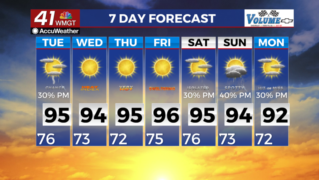
Overnight storm odds will climb, especially leading into the sunrise Wednesday morning. Almost if not all of Middle Georgia will get rain with this round as a cold front moves into the area and stalls out a bit. Expect the wind to be variable through much of the night, especially once rain begins. Severe weather is not expected however these storms will likely be the strongest this week. A bit of damaging wind or some hail cannot be ruled out. Low temperatures will be close to 10 degrees above the normal in the lower 60s. Expect the wind to be variable through much of the night, especially once rain begins.
Wednesday and Beyond


Storms are likely to get the day started across Middle Georgia on Wednesday and more are possible Thursday and Friday as well. Storm chances will likely peak on Saturday as a cold front moves into the area, stalls out, and becomes stationary. Sunnier days will return beginning Sunday.

Follow Chief Meteorologist Aaron Lowery on Facebook (Aaron Lowery 41NBC) and X (@ALowWX) for weather updates throughout the day. Also, you can watch his forecasts Monday through Friday on 41NBC News at 4, 5, 5:30, 6, and 11 p.m.


