Another Heat Advisory as heat builds through the week
MACON, Georgia (41NBC/WMGT) – The short term period is characterized by an upper level ridge continuing to amplify and spread east over the region. This ridge will continue to pump 


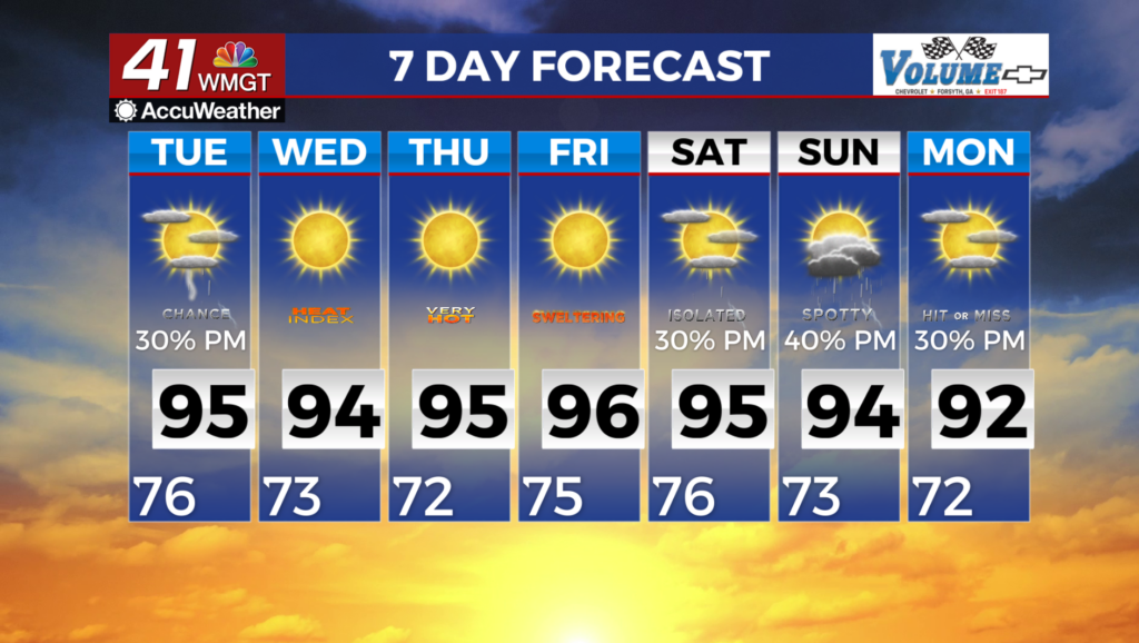
heat into the region as temperatures continue their climb under this ridge. Dewpoints will remain in the low to mid 70s while combining with these hot afternoon temperatures will lead to heat indices in the mid 100s just about everywhere. Locations in East Middle Georgia will furthermore see heat indices in the upper 100s and approaching 110 degrees in the peak heating hours. Another Heat Advisory is in effect from 12 noon to 8 PM Tuesday. If you plan to spend time outdoors, take the necessary precautions, drink plenty of fluids, take frequent breaks in the shade or air 


conditioning. With the axis of this ridge centered over Alabama today, weak shortwave disturbances are expected to continue traversing around the eastern side of the ridge, moving from eastern Tennessee towards the Georgia/South Carolina coast. As a result, scattered thunderstorms are likely to develop over far northeast Georgia late afternoon, spreading south through eastern Georgia 
through the evening, with lesser chances to the west. Storms that do develop will be capable of producing frequent lightning, heavy rainfall, and gusty winds. We are not expecting widespread and organized severe weather at this time. The high pressure regime continues Tuesday, with conditions expected to be very similar to today. Low temperatures in the mid to upper 70s once again will not provide relief from the hot conditions during the day. High temperatures and heat indices on Tuesday will be in the mid 90s and mid 100s respectively across all but the far northern tier, which will warrant another Heat Advisory for Tuesday. With the axis of the ridge shifting further to the east, afternoon thunderstorms will be more diurnally-driven in nature.