

A gradual warm up on the way
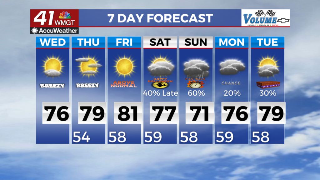
MACON, Georgia (41NBC/WMGT) – Dry, temperate, and mostly sunny conditions persist through the short term period. At the surface, high pressure presently centered over Quebec into 


northern New England will gradually slide off the Atlantic coastline through Wednesday evening, maintaining our ongoing Cold Air Damming setup. Meanwhile, ridging aloft will gradually begin to flatten today in a transition to southwesterly flow ahead of a weekend storm system. What this means for perfect weather is more of the same that we’ve seen over the past week or so; overnight and morning temperatures remaining cool (lows in the 40s to low 50s Wednesday morning) temperatures moderating to more widespread 50s for many areas by Thursday morning, with 


highs near normal on Wednesday (high in the 70s for most). High pressure over the Southeast is expected to spin in place through the rest of the work week and into the weekend. As the days continue to grow shorter and the leaves drop, we’ll need to be mindful of the combination of dry fuels and low relative humidity as we begin the Fall Fire Season. Temperatures during the daytime will climb into the low to mid 70s across most of the coverage area before we see some low 80s before the weekend as the winds swing around to the south. As that high pressure begins to break down, 
we’ll see the chances of showers and possibly a thunderstorm start to increase late on Saturday evening before sweeping through on Sunday. While the threat of severe weather is marginal, the models do show a decent amount of rain on Sunday. Current drought conditions should minimize the overall flood threat, although some localized flash flooding will be possible with training storms and in the metro area. The system clears out late Sunday, giving us a few more days of clear Fall weather before the models start disagreeing on what’s coming next.