A dry and quiet start to the new week
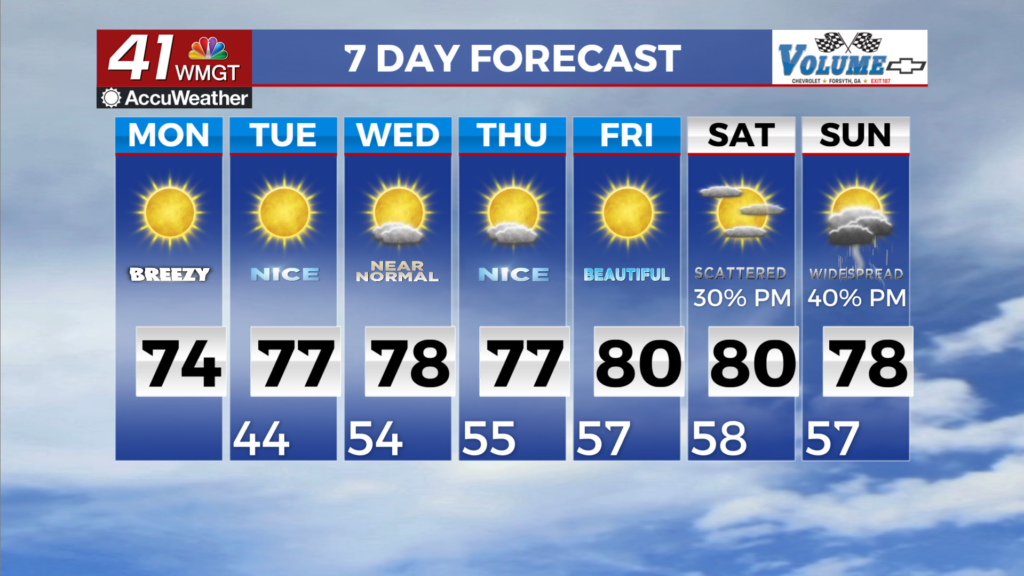
MACON, Georgia (41NBC/WMGT) – A quiet start is in store over the long term forecast for our area with a continuation of the sunny and dry conditions through the end of the upcoming work 


week. At the mid and upper levels, conditions remain dry, with low Relative Humidity values associated with a ridge that will break down by the end of the week. At the surface, high pressure centered over the Mid-Atlantic will weaken by mid-week, and be absorbed into stronger surface high pressure transiting the northeast coast. Ultimately, this set up will continue to support a general northeast wind component channeled along the leeside of the Appalachians into our area through the end of the week. While we will have slightly moister low levels due to the northeast to 


east component of our surface winds, some dry air and lower Relative Humidity values will filter over our area by Tuesday, so we will see if a Fire Danger Statement will be issued. Otherwise expect temperatures to climb each day through the week, with daytime highs rising from the low to upper 70s up into the low 80s over Middle Georgia by Friday into Halloween weekend. Looking 
ahead to next weekend, models suggest a shift in the pattern becoming more zonal by the end of the week. As far as precipitation is concerned, rain chances do look to be on the increase by the end of the long term, but models are not in agreement with the development or placement of the surface low pressure. As a result, whether we see any precipitation or the extent of coverage, that will have to be fine tuned as we progress over the next few days. At this time, precipitation chances are still low for Halloween night.