Front brings continued rain chances Tuesday
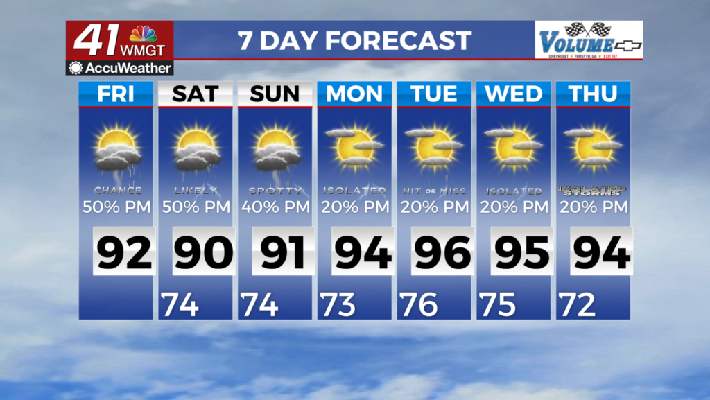
Rain will be in the forecast in Middle Georgia for most of the week with highs in the 90s until the weekend.

We saw a hot day in Middle Georgia today, with highs warming to the low 90s (which is normal for this time of year).
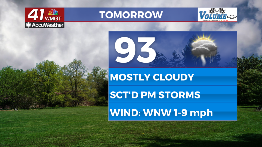
Highs tomorrow will warm back to the low 90s with partly cloudy skies to start the day.
By the afternoon/evening hours a cold front will approach the area, and bring our next chance of rain.
We are not expecting severe storms, but a few could be strong. 
Scattered showers and storms during the afternoon will be hanging around for Wednesday as well, but coverage will be a bit less.
Wednesday, right now, looks like the driest day of the week.
Highs through Thursday will be staying in the 90s.
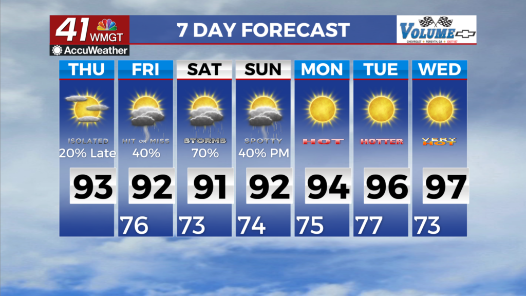
By Thursday and into Friday we will start to see our next rain maker push back in, bringing the chance for some heavy rain.
This does mean we could see some rain at high school football Friday evening.
We are also seeing the tropics really starting to wake up.
There are 4 systems the National Hurricane Center is monitoring for development.
Only one of these systems has a high chance of formation in the next 5 days.
That system is likely to head towards the east coast, but not make landfall.
That being said, it is still pretty far out, so we will have to watch closely.

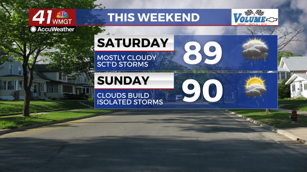
The good news for the weekend, is that despite the increased rain chances, temps will be a bit cooler.
Highs over the weekend will stay in the mid and upper 80s, mainly due to the rain and additional cloud cover.
Labor Day should still be nice if you are going to be outdoors, but storms will still be possible.