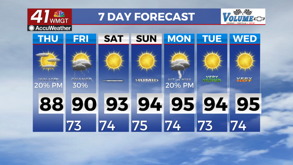
Temperatures to keep warming around Middle Georgia
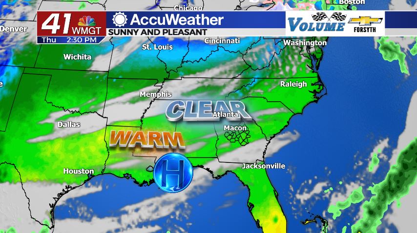
MACON, Georgia (41NBC/WMGT) – Another day of sunshine is leading to more warmth around the Peach State.
Today


Conditions were cold again to begin the day in Middle Georgia with several spots beginning the day below freezing. Fortunately warm conditions will arrive rather quickly with most if not all locations in the region likely to eclipse 60 degrees by noon. There will not be much wind today; it’ll mainly blow from the west and west-southwest at about 5 mph with gusts between 5 and 15 mph. Highs will reach the upper 60s for most spots in Middle Georgia but a few cities will likely reach the 70 mark. A few high level clouds will likely pass over during the afternoon hours, and some will stick around into tonight.


Overnight temperatures will drop quickly again even though a few clouds will hang around overhead through the night. These will still be high level cirrus clouds, but they should provide enough insulation that we remain above freezing everywhere in Middle Georgia heading into tomorrow morning. Overnight winds will remain out of the west-southwest at 5 mph.
Tomorrow


Following another chilly morning temperatures will again warm up quickly under sunny skies. Cloud cover is expected to be less than Thursday afternoon as temperatures climb into the upper 60s and lower 70s around the region. The wind will be aiding in this warmup as it shifts to the southwest at 5-15 mph with gusts between 10 and 20 mph. This will also allow humidity to climb a bit heading into Saturday when the next cold front is expected to arrive.


Overnight a couple of clouds will fill in, but blanket conditions are highly unlikely. A stubborn high pressure over the southeastern US and Georgia will limit the development of a warm front, keeping overnight lows rather chilly. Temperatures will bottom out in the lower 40s and upper 30s heading into Saturday morning.
Saturday and Sunday


Despite the fact that a cold front is arriving on Saturday cloud cover is only expected to increase so much. There may be blanket conditions in part of the state, however that stubborn high pressure will likely limit cloud cover over Middle Georgia during the afternoon hours of Saturday. Highs will reach the lower 70s across the region during the afternoon hours. The front itself will be quite weak as it arrives during the evening hours and shifts the wind from the southwest to the northwest at 10-15 mph. In fact, the cold front is so weak and the high so stubborn that rain is highly unlikely for most of Middle Georgia.


Overnight is when rain will be more likely, but only in a few counties. Showers are expected to develop in South Georgia heading into Saturday night, and counties such as Telfair, Wheeler, Wilcox, and Dodge will have the best chance to see them. There likely will not be any activity outside of those counties and only limited cloud cover to go with it. These clouds should be gone by Sunday morning.

Sunday will see completely sunny skies return again as high temperatures only reach the mid to upper 50s following the cold front’s passing. Sub-freezing conditions will return overnight.

Temperatures will begin to warm quickly next week with low temperatures jumping late week as well, indicating a jump in humidity. There is nothing to be concerned with in the next seven days, however this could potentially set the stage for a severe threat late next week or next weekend.

Follow Meteorologist Aaron Lowery on Facebook (Aaron Lowery 41NBC) and Twitter (@ALowWX) for weather updates throughout the day. Also, you can watch his forecasts Monday through Friday on 41NBC News at Daybreak (6-7 a.m.) and 41Today (11 a.m).


Leave a Reply