


Last day of the rain train
MACON, Georgia. (41NBC/WMGT) – Stormy weather will finally move out of Middle Georgia later today.
Today
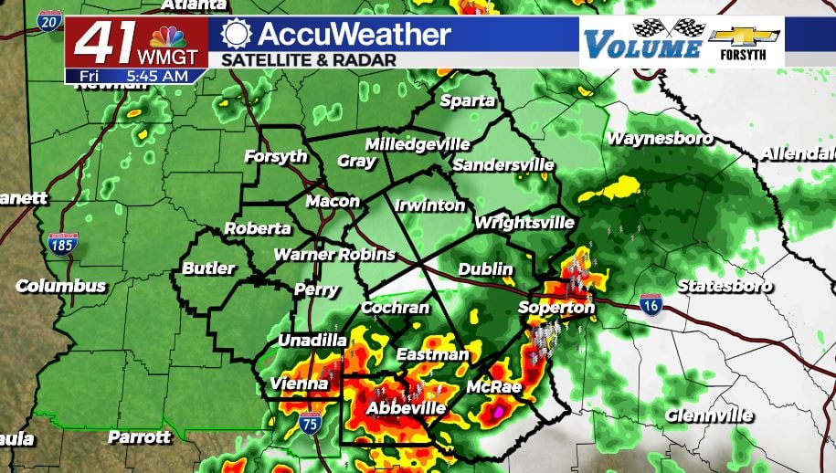
It is a soaking wet start for several parts of Middle GA. The southeastern counties of the region in particular opened up this morning with heavy rain and several flash flood threats. Flash Flood Warnings are going to remain in effect for much of that region until about 11:00 am. Thunderstorms are expected to move out of Middle GA during the early lunchtime hours, giving way to mostly sunny skies. There will still be some scattered showers and storms this afternoon and evening as temperatures climb into the upper 70s and lower 80s yet again. Shower activity should subside during the early overnight hours as most of the clouds clear out. However, by Saturday morning more cloud cover will return as temperatures bottom out in the mid 60s.
Tomorrow
Saturday will kick off with a relatively cloudy start after they fill back in during the early morning hours. Rain is not expected to accompany these clouds early, however sunshine in the afternoon will fuel the possibility for a few rounds of scattered showers. These will bring some light rain, the heavy rain should be gone by the lunchtime hours of Friday and will not carry into the weekend. Temperatures for tomorrow afternoon will primarily be in the lower 80s around Middle GA with a few locations still hanging in the upper 70s. Weather will be much improved if you have plans to go to the Georgia National Fair, however it will still be a good idea to bring an umbrella because of PM scattered showers. Overnight cloud cover will clear out as low temperatures fall into the lower 60s.
Sunday and Next Week
Even less cloud cover is expected on Sunday as temperatures across the region climb into the lower to mid 80s. A few isolated showers will still be possible during the afternoon hours, but conditions will be even more pleasant than Saturday as humidity falls further and sunshine becomes more widespread. Any showers that pop up in the afternoon should clear out by sunset, once again providing clear skies overnight. Low temperatures will fall into the lower 60s heading into Monday morning.
The coming week will be much calmer than the deluge that was this past week. A few isolated showers will be possible Monday afternoon, however rain chances practically vanish for the work week beyond that. Temperatures will rise a few degrees each day in regards to both highs and lows, remaining above average for this time of year. The chances for rain for the second week of October is below average for this time of year.

Follow Meteorologist Aaron Lowery on Facebook (Aaron Lowery 41NBC) and Twitter (@ALowWX) for weather updates throughout the day. Also, you can watch his forecasts Monday through Friday on 41NBC News at Daybreak (6-7 a.m.) and 41Today (11 a.m).


Leave a Reply