

Warmer Friday, severe storms possible Saturday
After a chilly day in Middle Georgia today, we will be starting to warm up a bit Friday.
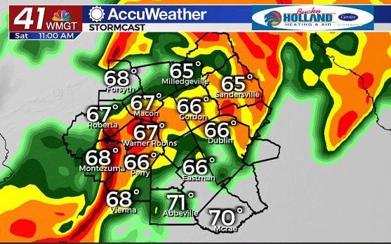
Expect another cool start (in the upper 30’s), with clouds increasing through the day and highs returning to the mid 70’s.
This is all to set us up for a strong storm system to move through Saturday.
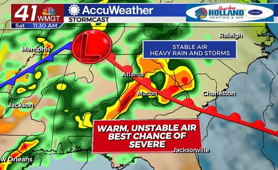
Starting Saturday morning, an area of storms will be approaching Middle Georgia.
These initially won’t be severe, but as a warm front lifts in from the south, we will start to see a chance for some strong storms with potential rotation and damaging wind gusts.
As far as timing is concerned the latest models are suggesting we will see this first round of storms rolling in after around 8 am.
Be sure to have a way to get your warnings that will wake you up Saturday morning, in case any of these storms roll in early.
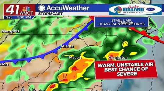
Behind the first round of storms, there are still some questions about how well the atmosphere will recover for the potential of strong storms during the afternoon.
Regardless of strength, expect another round of showers and storms to roll through during the afternoon/evening.
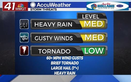
We will be seeing all modes of severe weather possible on Saturday, with the main threats being heavy rain and gusty winds.
During the morning hours it appears the threat for a brief tornado will be a little higher than during the afternoon.
By the afternoon, large hail will become a threat with storms that move through.
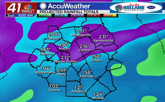
Heavy rain will be likely across Middle Georgia through the day on Saturday as 1-2″ is possible widespread.
A few areas could see some flash flooding, especially urban areas.
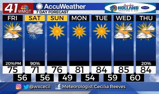
By Sunday the skies will clear and weather will remain quiet for much of next week.
Highs will be warming back to the mid 80’s through the week, with our next chance of rain moving in by late next week.
Leave a Reply