

A slight cool-down rounds out work week and continues into the weekend
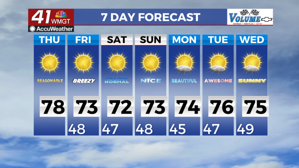
MACON, Georgia (41NBC/WMGT) – Dry conditions and pleasant, along with near-seasonal temperatures are expected through Thursday night. Northerly flow aloft and high pressure across the 


Southeast will maintain zero chance for rain and very little in the way of clouds. The dry air in place will make for elevated fire danger this afternoon. While winds will be light overall, low relative humidity could support rapid fire development. A Fire Danger Statement is in effect across most of North and Middle Georgia until 7 PM this evening. Expect little change in the long-term forecast with a building mid-level ridge centered over Texas and associated troughing oriented along the eastern seaboard, which will continue to amplify through Friday and shift off the coast by the 


weekend. Dry conditions will continue to be the theme with no chance of rain through at least the end of next week. This pattern will reinforce the seasonably cooler conditions over our area through the first of next week. A resulting backdoor cold front will move through by Friday, increasing surface winds out of the northeast to around 5 to 10 mph, with afternoon gusts up to 20 mph through the weekend. We expect overnight lows to drop into the low to upper 40s and daytime highs ranging from the low 60s to upper 70s areawide this weekend. Expect a gradual warming trend as we move into the second half of next week.