Stationary front to bring more storms Friday
MACON, Georgia (41NBC/WMGT) – A cold front will stall out over Georgia Friday becoming stationary bringing another round of storms to cap off the week.
This Evening


Scattered storms are ongoing across Middle Georgia and are likely to continue through this evening into early tonight. A few showers could possibly stick around past midnight. The most intense storms may bring wind gusts over 40 mph with the peak ones possibly eclipsing 60 mph. This would qualify as a severe thunderstorm. No parts of Middle Georgia have been highlighted on the 1-5 severe risk scale, however. Temperatures will valley in the lower 70s under mostly cloudy skies accompanied by light wind from the south-southwest. There is a full moon tonight, the Full Sturgeon Moon, named for the once abundant fish in North American bodies of fresh water. It will be hard to see the moon due to cloud cover, however. It is also a total Lunar Eclipse, meaning it will be a rather bright and large moon for those that can see it. Fog will also be possible into the early hours of Friday.
Tomorrow


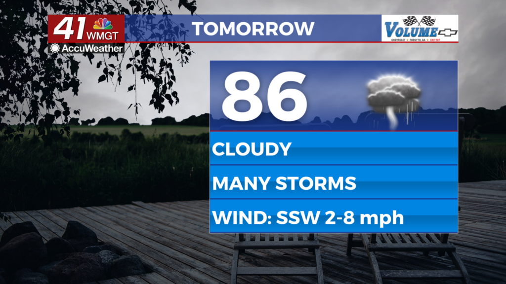
Friday may be the cloudiest day of the week as the cold front responsible for storms today stalls out and becomes stationary. This will lead to another round of storms across Middle Georgia for Friday afternoon and evening. As of now no parts of Middle Georgia are included in the categorical severe risk, however the Level 1 “Marginal” threat zone to the north could expand south to include a couple of Middle Georgia counties. The most intense storms will bring wind gusts over 40 mph and could have some small hail. Temperatures will top off in the mid to upper 80s with the warmest locations reaching the lower 90s. The wind will remain light out of the south-southwest.


A few showers or a storm may linger into the overnight hours as skies remain overcast. Temperatures will drop into the lower 70s with a couple spots possibly falling into the upper 60s. The wind will be light and variable. More fog will be possible heading into Saturday morning.
This Weekend and Beyond


Mostly cloudy skies are likely again Saturday with around half of Middle Georgia seeing showers and storms throughout the day. A few isolated storms are also likely on Sunday as a bit more sun tries to break through. Next week the rain odds will plummet as temperatures soar leading into September. The odds for another heat wave early next month are continuing to increase.
Watching the Tropics

The timing really couldn’t be worse for the next named storm in the Atlantic as Tropical Storm Dolly has formed two days after the passing of the legendary country artist. It isn’t expected to intensify much as it meanders west towards the Lesser Antilles.

Follow Chief Meteorologist Aaron Lowery on Facebook (Aaron Lowery 41NBC) and X (@ALowWX) for weather updates throughout the day. Also, you can watch his forecasts Monday through Friday on 41NBC News at 4, 5, 5:30, 6, and 11 p.m.