Another carbon copy of yesterday’s wet conditions
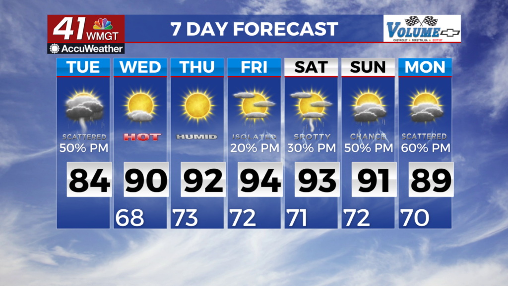
MACON, Georgia (41NBC/WMGT) – Very wet conditions conditions continue for Middle Georgia. Convective showers with limited lightning have developed across the western counties. Slow 


moving and training heavy showers are possible today. Rain showers will be efficient while potentially not reaching high enough to develop lightning. Rainfall rates may reach 2 to 3 inches per hour without triggering much or any lightning. Any storms that do produce lightning will likely see some of the heaviest rainfall. The flood risk will dependent on where storms set up. Rainfall amounts which are likely for areas of North Georgia are 1 to 2 inches, decreasing to the south and east. Overall instability are severe potential will be limited by cloud cover and water loading within storms. Chances for heavy rain continue today and to a lesser extent Wednesday. Moisture remains in place, however upper level forcing continues to move eastward out of the area through Wednesday. Temperatures remain moderated by significant cloud coverage and precipitation. High will be in the mid to low 80s. Lows will also be moderated in the upper 60s but gradually increase to the low 70s Wednesday morning. The long term forecast starts Wednesday where moisture remains in place across the southeast, especially at the surface, although it isn’t 


quite as moist as the previous few days. A strong surface low will be moving well to the northwest of the area across the Upper Great Plains and Canada, while a surface high slides off the East Coast into the classic Bermuda High position. These in tandem will keep surface moisture flowing into the area. A short wave ridge builds in the upper levels Wednesday, bringing with it some suppression of convection with warming upper levels, that sticks around through Thursday. Given moisture remains plentiful, expect at least isolated to scattered afternoon and evening thunderstorms across north and Middle Georgia both days. A cold front is set to sweep towards the coverage area on Friday but stall before arriving. Depending on the southward progression of the front, rain chances may increase or decrease across northern Georgia. Further north may decrease them, while further south will allow for some additional pooling of moisture and lift associated with the front to reach into North Georgia. This front lingers through the weekend keeping moisture around and diurnal chances of showers and storms in place. We will also see temperatures climb into the 90s in many areas Friday and Saturday ahead of the main system, which will bring heat indices into the mid to upper 90s for the first time in quite awhile.