
Cold front to bring showers and storms overnight
MACON, Georgia (41NBC/WMGT) – A cold front pushing south will bring showers and perhaps a couple of thunderstorms overnight tonight and tomorrow around Middle Georgia.
This Evening
A partly sunny afternoon should remain pleasant although warm through the evening. However more clouds should arrive heading into the overnight hours ahead of the arrival of a cold front. This front will keep the wind out of the northwest through tonight and bring a few showers and maybe a thunderstorm or two. Temperatures will still be rather warm heading into tomorrow morning with lows expected in the upper 60s across most of the region.
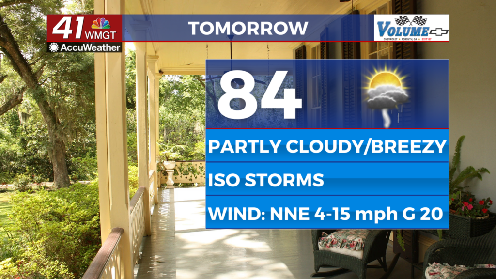
Tomorrow
Another partly cloudy day is likely with temperatures topping off in the mid 80s once again. Real feels may reach the lower 90s in parts of the region. The wind will flow from the northeast at 5-15 mph with gusts to around 20 mph, so expect it to be a bit breezy through the afternoon. Isolated showers and storms will also be possible over the latter half of the day.


Overnight clouds will clear and temperatures should valley just below 60 degrees for a good chunk of the region. That’s between 5-10 degrees below the average for this time of year. The northeasterly winds will continue at 5-12 mph with gusts hovering around 15-17 mph.
Wednesday and Beyond
Thanks to the cold front conditions will be rather pleasant Wednesday with many high temperatures expected in the upper 70s! To go with that will be the coolest night seen in a few weeks as temperatures will valley into the mid 50s leading into Thursday. A reversal of the current trend is likely into the weekend as the wind returns to out of the southeast this coming weekend.

Follow Chief Meteorologist Aaron Lowery on Facebook (Aaron Lowery 41NBC) and X (@ALowWX) for weather updates throughout the day. Also, you can watch his forecasts Monday through Friday on 41NBC News at 4, 5, 5:30, 6, and 11 p.m.