


Storm chances finally return this weekend
MACON, Georgia (41NBC/WMGT) – Scattered storms are likely Saturday and more activity could be possible Sunday as a cold front stalls out over Georgia this weekend.
This Evening
Partly sunny and warm conditions will continue through the evening before things become more mild overnight. Expect low temperatures to hover in the mid to upper 50s around the region. The wind will flow from the southwest around 5 mph. Overhead skies should be mostly clear, however a bit of that smoky haze may stick around. Air quality has improved over the last couple of days ever so slightly.
Tomorrow
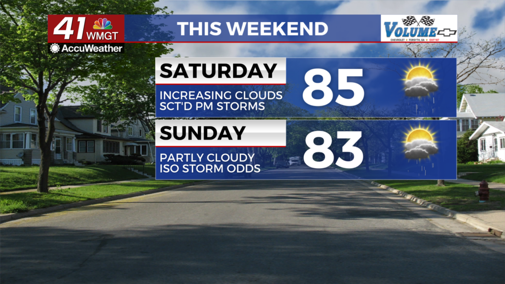
Plenty of sun is likely early before more clouds fill in during the lunchtime hours ahead of storms. Temperatures will peak in the mid to upper 80s around the region with afternoon and evening storms cooling the locations down that receive them. While not everyone in Middle Georgia is guaranteed to see rain more than half of the region should. Severe weather is not expected however the most intense storms may bring some strong wind gusts or small hail. The wind will flow out of the southwest at 5-13 mph with gusts pushing 15-20 mph.


Overnight will be mostly cloudy with some showers and storms lingering early on. Expect low temperatures close to 60 degrees around the region accompanied by light wind from the west-southwest.
Sunday and Beyond
Conditions will likely be a bit cooler Sunday afternoon with a shift to the northwest expected with the wind early Sunday. A few showers or perhaps a storm will be possible during the day however the odds for rain look a lot lower than Saturday. Sunny skies are likely to begin the next work week before more storm odds return during the middle of the week.

Follow Chief Meteorologist Aaron Lowery on Facebook (Aaron Lowery 41NBC) and X (@ALowWX) for weather updates throughout the day. Also, you can watch his forecasts Monday through Friday on 41NBC News at 4, 5, 5:30, 6, and 11 p.m.