Heat sticks around Saturday before a cold front cools things off Sunday
MACON, Georgia (41NBC/WMGT) – Temperatures will push the 90s again Saturday afternoon however Sunday will see more seasonal if not below average conditions thanks to a cold front.
This Evening


Scattered cumulus clouds from the afternoon should largely clear into the late evening, however some scattered high-level clouds are likely to pass through during the overnight hours. Temperatures should largely stay above 60 degrees across Middle Georgia tonight. The wind will be light out of the west.
Tomorrow


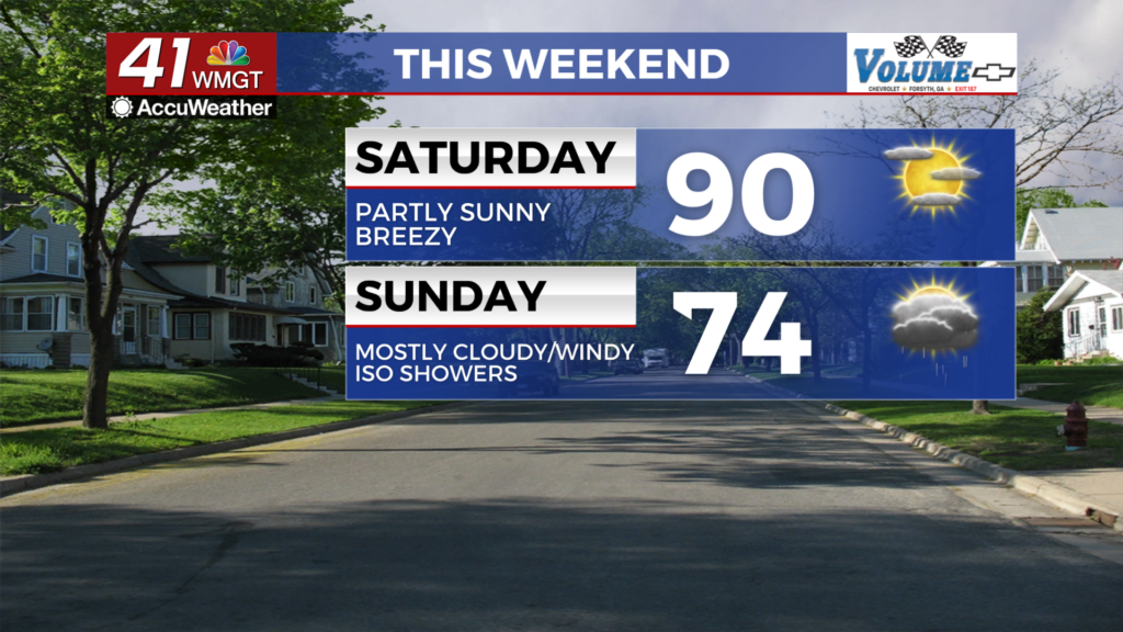
Another hot day is expected Saturday with plenty of sunshine over the first half of the day. Scattered clouds at the upper and mid levels are likely throughout the afternoon, however. Temperatures should be similar to Friday with many spots getting close to 90 degrees in the afternoon. The wind will be a bit breezy from the southwest at 5-12 mph. Gusts should range from 15-20 mph. Those spending time outside would be wise to stay hydrated and keep the sunscreen handy as the UV Index values around the region will hover close to 10 in the afternoon. This translates to 30 minutes or less before burning begins for those unprotected.


Overnight more clouds are expected to arrive as a cold front approaches from the northwest. The front should arrive in the northwestern counties just ahead of the sunrise on Sunday. It may come with a few showers, but the shift in the wind direction will be noticeable Sunday morning as an increase in velocity is expected as that happens.
Sunday and Beyond


Sunday will be a windy day once the direction shifts from the southwest to the north-northwest with the arrival of the cold front. Shower activity will be limited with the northwestern counties likely to see the most rain as the odds for the activity will decrease as the front continues to push southeast. Temperatures in the afternoon will range from the lower 70s into the lower 80s with the warmest spots likely to be in the southeastern counties. Expect conditions to plummet into the low to mid 40s by Monday morning.

Next week will start off below average with temperatures and will feature plenty of sunshine. A gradual warmup is expected throughout the week. Rain chances remain negligible.

Follow Chief Meteorologist Aaron Lowery on Facebook (Aaron Lowery 41NBC) and X (@ALowWX) for weather updates throughout the day. Also, you can watch his forecasts Monday through Friday on 41NBC News at 4, 5, 5:30, 6, and 11 p.m.