
More storm chances Friday
MACON, Georgia (41NBC/WMGT) – Another round of scattered afternoon and evening storms is expected on Friday.
This Evening
A partly sunny and warm afternoon will become a mostly clear and mild night around Middle Georgia. A stray shower or perhaps a storm remains possible but the odds are quite low. Temperatures will valley in the upper 50s and lower 60s as the wind flows from the south-southeast around 5-10 mph. More fog is likely again leading through the sunrise hours on Friday.
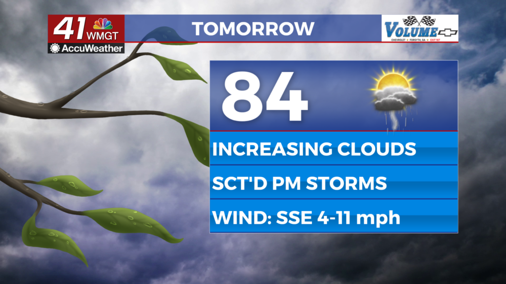
Tomorrow
A lot of sun is likely early on Friday however cloud cover will fill in throughout the middle of the day. Temperatures will peak in the low to mid 80s accompanied by winds from the south-southeast at 5-12 mph.


As for storms the first ones will likely fire between noon and 2 pm, becoming more widespread as the afternoon and evening continue. Overall severe storms are not expected however the most intense storms may have hail up to an inch in diameter and could bring downdraft wind gusts of 40+ mph. Frequent cloud-to-ground lightning is also likely.


A few storms will linger into the early parts of the night before muggy conditions stick around into the weekend. Overnight lows will be in the lower 60s around the region accompanied by light wind still from the south-southeast. More fog is also likely heading into the start of Saturday.
Easter Weekend
Both days of the coming weekend will have storm chances, especially Easter Sunday thanks to an incoming cold front. While Saturday’s odds should be contained to the afternoon and evening hours rain now looks to be possible throughout the day on Sunday. This is reflected in the expected high temperatures as Saturday should mostly see lower 80s while Easter sees temperatures largely in the 70s. The cold front will lead to below average temperatures early next week.

Follow Chief Meteorologist Aaron Lowery on Facebook (Aaron Lowery 41NBC) and X (@ALowWX) for weather updates throughout the day. Also, you can watch his forecasts Monday through Friday on 41NBC News at 4, 5, 5:30, 6, and 11 p.m.