


Showers this evening will lead to thunderstorms early Friday
MACON, Georgia (41NBC/WMGT) – An incoming slow moving cold front is bringing showers and eventually thunderstorms to Middle Georgia to end the work week.
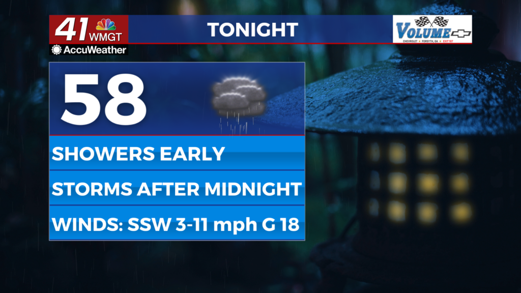
This Evening
Cloud cover filled in during the day Wednesday and showers began early this morning around the region. The number of those is expected to continue to grow as the evening progresses. It will be another warm night with temperatures once again expected to valley in the upper 50s and lower 60s. The wind will predominantly remain out of the south-southwest at 5-12 mph with gusts ranging from 15-25 mph.


The odds for thunderstorms will climb after midnight tonight, however severe weather is not expected. A few relatively strong wind gusts will be possible when storms first arrive, however.
Tomorrow
Rain and likely a bit of thunder will be ongoing as the sun comes up Friday morning. Middle Georgians should give themselves time for longer commutes tomorrow as a result of wet roads and lower visibility. While the heaviest rain is likely to start ahead of the sunrise it will continue into the late morning hours before slowing some. Light rain will remain possible into lunchtime and possibly the mid-afternoon in the southeastern half of the region. No severe weather is expected with any of this rain, however the slower it goes and the heavier the rain is some low-lying areas could have a slight flash flooding risk.


Outside of the wet conditions the wind will finally be a bit calmer as it will be variable while the rain is ongoing, shifting to the northeast once it is through. Temperatures will largely reach into the upper 60s and lower 70s once again. Cloud cover is expected to stick around even once the rain tapers off.


Overnight will be mostly cloudy with a few spotty showers remaining possible. The wind will flow from the east-northeast around 5 mph. Low temperatures will largely be in the low to mid 50s.
This Weekend
Clouds from the slow moving system will stick around through at least the morning hours Saturday before starting to break up. The southern half of the region may see those clouds linger into the sunset hours before breaking. Those who like to see stars in the sky will need to hope those clouds break earlier as shortly after the sunset on Saturday six planets will be visible just above the horizon. A telescope will be needed to see all six.

Sunday will be warmer and sunnier as March begins. Conditions should stay pretty warm into the new week.

Follow Chief Meteorologist Aaron Lowery on Facebook (Aaron Lowery 41NBC) and X (@ALowWX) for weather updates throughout the day. Also, you can watch his forecasts Monday through Friday on 41NBC News at 4, 5, 5:30, 6, and 11 p.m.