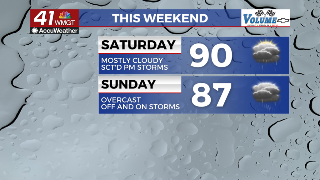
Low humidity leads to elevated fire dangers today
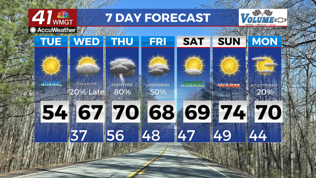
MACON, Georgia (41NBC/WMGT) – Middle Georgia will transition away from cold air today as high pressure formerly over the Mississippi River Valley settles into the Gulf. This brings 


southwest winds to the region this afternoon and allows high temperatures to climb into the 50s. It will take some time for moisture to return with the southwest flow, therefore, very low humidity values should occur this afternoon. Relative humidity values in the 20 to 29 percent range and dry fuels will increase the risk for fire starts. A Fire Danger Statement has been issued for North and Central Georgia. The humidity will be lowest between 11 AM and 7 PM. Low level moisture from the Gulf will filter back into the state tonight and Wednesday morning. As a result low cloud cover is possible in North and Middle Georgia Wednesday. Temperatures will continue to climb on Wednesday as well, resulting in widespread high temperatures in the 60s. Wednesday night surface high pressure moves from the Eastern Great Lakes region towards southeast Canada. As it continues to move northeast, a cold front extending from this same system will slow near the Tennessee/Kentucky state line. Scattered light showers will enter far north Georgia late Wednesday night, advancing southward through the early morning hours. Southwesterly flow will continue to bring in warm moist air from the Gulf Wednesday night into the early morning hours. Within warm air advection and underneath an insulating layer of clouds, lows on Thursday morning will be in the low to mid 50s. On Thursday, a shortwave moves out from the Great Plains through the mid-Mississippi River Valley, with a surface low developing along the frontal boundary. The movement of this trough and low will help push the lingering front southward towards Georgia. As this occurs, showers become more widespread across the majority of north and Middle Georgia during the daytime on Thursday into Thursday night.