
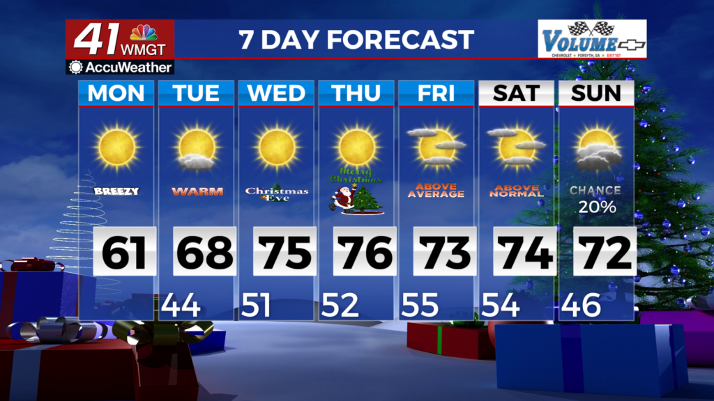
A warm and dry week ahead
MACON, Georgia (41NBC/WMGT) – High pressure sliding over the Carolinas has turned winds out of the east across much of the north and Central Georgia, ushering in a drier and cooler 


 airmass. The low deck of clouds over the western half of the area this morning will gradually break up and lift thanks to the drier air moving in. By this afternoon, skies will be partly cloudy with breezy easterly winds, and high temps in the mid to upper 50s in north Georgia, and low to mid 60s in Middle Georgia. Today will be by far the coolest day of the week, as an expansive mid-level ridging starts to build across most of the central and southern U.S. tonight into Tuesday. Downstream of the ridge, a weak system moving across the Northeast U.S. kicks the surface high pressure over the Carolinas southwest across Georgia, settling over the northern Gulf. Low to mid level winds over Georgia will flip out of the west southwest in response, ushering in a much warmer airmass. Mid-level moisture also increases with this airmass, resulting in mostly cloudy skies tonight through Tuesday. While most of the area is expected to be rain-free other than a few sprinkles, there is a slight chance for light rain in far north Georgia. With the warmer airmass, afternoon high temperatures will surge into the mid to upper 60s in north Georgia, and upper 60s to low 70s in Middle Georgia.