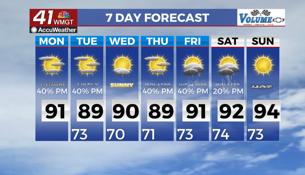
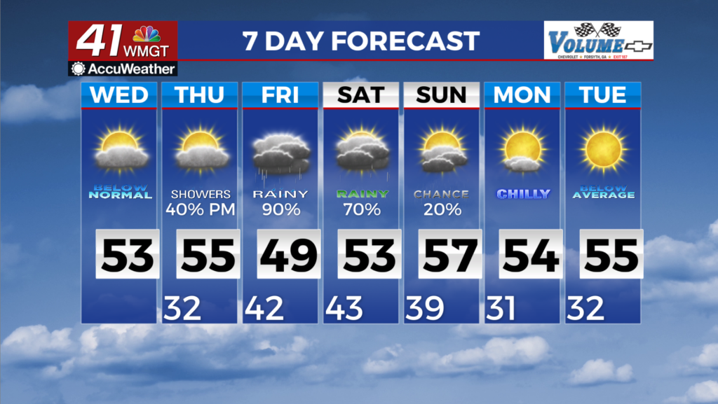
Dry today then rain returns late Thursday
MACON, Georgia (41NBC/WMGT) – The calm and sunny weather on Wednesday will be short-lived. Wednesday night into Thursday, a shortwave ridge moves northeast towards the Mid-Atlantic 


 coast and southwesterly upper level flow will set up across the Southeast once again. Increasing cloud cover will spread from west to east across the area into Thursday morning and will keep temperatures slightly warmer and more mild. Highs on Thursday will range from the upper 40s in far northwest Georgia to near 60 in East Middle Georgia. During the day on Thursday, a strong shortwave trough with connections on the Arctic side of the jet is expected to move across the Northeast portion of the coverage area. This will nudge a cold front southward towards north Georgia. In addition, as this trough quickly swings away to the northeast, a surface high sets up over the Appalachians and pushes east. A cold air wedge is then expected to develop along the lee side of the Appalachians and spreads into north Georgia late Thursday night into Friday. Another shortwave will then traverse the southern branch of the jet and along the southwesterly flow over the area Thursday into Friday. With a west to east zone in the vicinity of the cold front that nudged into the area, a surface low associated with the shortwave is likely to develop over the northern Gulf and move northeastward into the forecast area. Isolated light showers could enter the western portion of the region as early as midday Thursday. Rain will increase in coverage and spread east, and is expected to become widespread by Friday morning through much of the day. By early Saturday, rain chances will gradually trail off as the cold front begins to advance. At this time, this event will mainly be a cold rain event for us.