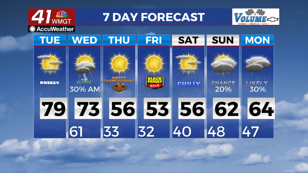
Showers & storms on the way as temps drop to seasonal levels

MACON, Georgia (41NBC/WMGT) – After several warm and mild days across the Southeast, a pattern change is on the way this morning. A surface low pressure system lifting across the 


 Midwest and into the Great Lakes region continues to deepen over the course of the day today. The attached cold frontal boundary spans a majority of states, and will sharpen and sweep eastward as the low strengthens. Ahead of the front, moisture has begun to rebound, with dewpoints in the mid-50s surging into the 60s by midday. North and Middle Georgia will be fairly well-removed from the parent system, however, sufficient forcing will exist to support the development of a line of showers and thunderstorms that will move from northwest to southeast across the forecast area during the afternoon and evening on Tuesday. Showers and thunderstorms are ongoing across Mississippi/Alabama out well ahead of the line of convection later today. Instability will be modest with the onset of diurnal heating this afternoon. As convective activity moves properly into North Georgia over the next coupe of hours, severe chances remain very low. It remains to be seen if the cloud cover associated with this potentially redeveloping convection ahead of the line eats away at the ceiling instability-wise. Expect this afternoon window where discrete cells may form ahead of a more organized line/ cluster of storms to be the one that carries our primary chances of seeing any severe hazards (damaging winds, hail, a tornado). Frontal forcing is likely to be stronger later. There is a risk for isolated strong to severe thunderstorms for much of North and Central Georgia. The Storm Prediction Center has placed a majority of the forecast area within a Marginal (level 1 out of 5) Risk for severe weather with probabilities geared toward the later window, generally afternoon through nightfall. Moving into Wednesday, frontal convection will be ongoing across the southern half of the forecast area through the night, continuing into the afternoon. Instability will gradually taper off after dark. Much drier air will filter in behind the front, so expect fairly rapid clearing into the afternoon. Most locations will see a return to sunny skies before we lose daylight.


