
Storm chances return Thursday as a cold front approaches
MACON, Georgia (41NBC/WMGT) – Middle Georgia will see widespread storm chances over the back half of the day as a cold front moves in from the west.
This Evening
A partly cloudy and hot afternoon will become a mostly clear night. A stray shower cannot be ruled out this evening however the overall odds for rain are low. Things will be a bit muggy as overnight lows will largely be in the mid to upper 60s accompanied by light wind from the southwest. Fog will be possible overnight and especially leading up to sunrise Thursday morning.
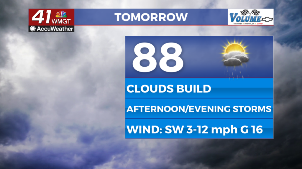
Tomorrow
A good bit of sunshine will be possible early after the AM fog lifts, however clouds will begin to fill in during the late morning hours. Highs will reach the upper 80s and lower 90s for most of the region before storms start to move in from the west during the mid-afternoon hours. Wind will flow from the southwest at 5-12 mph with gusts reaching over 15 mph.


A Level 1 “Marginal” threat for severe storms includes all of Middle Georgia tomorrow. This is due to the possibility of strong wind gusts with areas of heavy rainfall.


A few storms will linger into the night before the activity tapers off. Expect skies to stay cloudy and conditions to stay muggy as the wind remains out of the southwest at around 5 mph. Lows will mainly be in the upper 60s however a few low 70s will be possible in the warmer locations.
Friday and Beyond
The cold front responsible for Thursday’s rain is expected to stall out over Georgia Friday, leading to another round of widespread rain for Middle Georgia throughout the day. It will be a cloudy day with highs likely to hover around 80 degrees. Severe weather is not expected at this time however a Level 1 “Marginal” risk cannot be ruled out. The weekend should see a bit more sunshine return with rain odds dropping as the front clears the southeast coast.
The Tropics


Invest93L has just become Tropical Storm Humberto. There is much uncertainty with the track due to how it may interact with Invest94L as well as a cold front that will reach the Eastern Seaboard this weekend. Invest 94L is further west and also has solid odds to become a depression within the next week (80%). It will be interesting to see how these two systems interact with each other over the next several days as the Fujiwara effect will be possible, the front clearing the east coast could affect the way these are steering as well as other variables. Georgians and those along the US East Coast should absolutely monitor both systems in the meantime.

Follow Chief Meteorologist Aaron Lowery on Facebook (Aaron Lowery 41NBC) and X (@ALowWX) for weather updates throughout the day. Also, you can watch his forecasts Monday through Friday on 41NBC News at 4, 5, 5:30, 6, and 11 p.m.