Abundance of sunshine begins September
MACON, Georgia (41NBC/WMGT) – Below average temperatures and mostly sunny skies begin the new week across Middle Georgia.
This Evening


Labor Day has been gorgeous weatherwise across Middle Georgia with several spots today only climbing into the upper 70s and lower 80s for afternoon highs. The wind has also added a pleasant breeze from the northeast at 5-15 mph. Overnight will be clear and cool with lows expected to hover around or just above 60 degrees. Wind will continue from the northeast at around 5-10 mph.
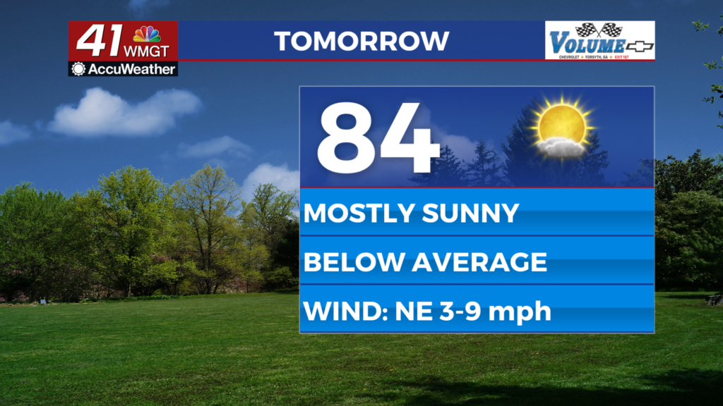
Tomorrow


Tuesday will be mostly sunny and again below average with highs likely in the low to mid 80s across the region. Wind will still be out of the northeast at around 5-10 mph. Rain is not expected.


Overnight will be mostly clear however a bit warmer than Monday night as the wind becomes more easterly. Expect lows in the low to mid 60s. Upper 50s are not expected ahead of Wednesday morning.
Wednesday and Beyond


Wednesday may have a few more clouds and a couple of isolated showers and storms will be possible, however most of the region should stay dry. Wind will be out of the southeast starting Wednesday and should stay that way through the rest of the week. This will allow both the temperatures and humidity to climb ahead of the weekend. Rain odds will overall be low during this timeframe.
The Tropics

A tropical wave that has come from the west coast of Africa has 50% odds to develop into a depression in the next 7 days and 10% odds over the next 48 hours. With its current trajectory this disturbance warrants observance in the coming days/weeks.

Follow Chief Meteorologist Aaron Lowery on Facebook (Aaron Lowery 41NBC) and Twitter (@ALowWX) for weather updates throughout the day. Also, you can watch his forecasts Monday through Friday on 41NBC News at 4, 5, 5:30, 6, and 11 p.m.