
Another hot day as some may see a shower
MACON, Georgia (41NBC/WMGT) – A fairly typical summer day is expected today. Isolated afternoon and evening thunderstorms may occur between 2 PM and 10 PM. Wind shear will be non 


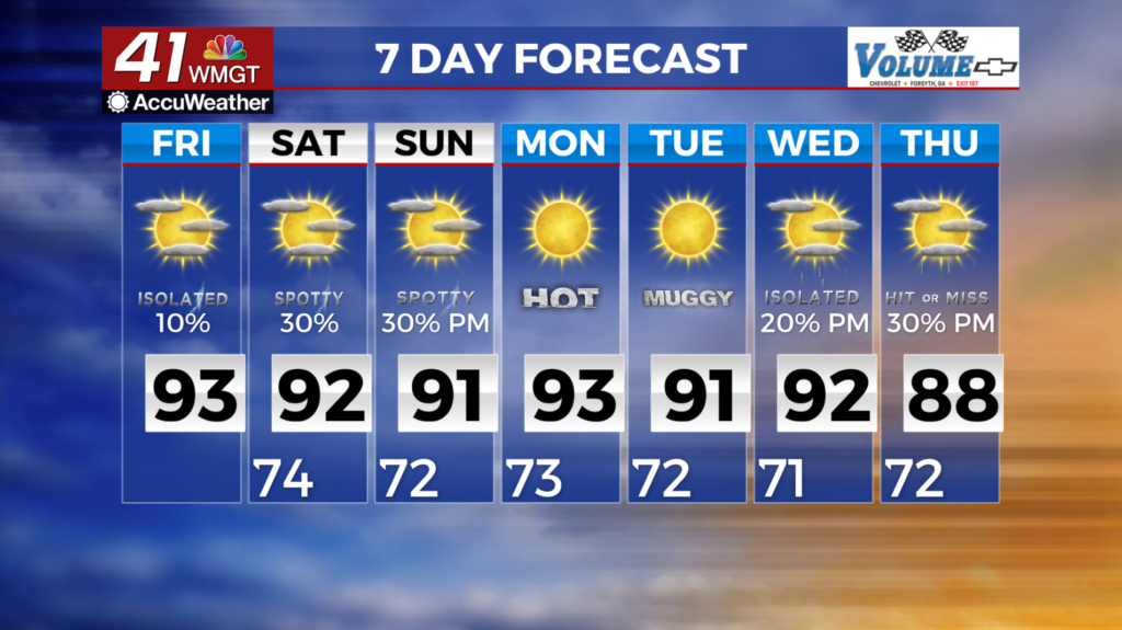
 existent as this will greatly limit the potential for severe weather. Isolated downburst winds near 40 mph and high rain rates for brief periods could occur. Storm motion should also be slower today as this may be supportive of some brief and localized flooding concerns. Overall storm coverage doesn’t appear extensive — about 30 percent. Friday will be the warmest day of the week. Look for high temperatures to reach the low to mid 90s. Combine these numbers with afternoon dewpoints in the lower 70s, and widespread heat indices in the 98 to 105 degree range can be anticipated. Models are in agreement that a mid-level ridge will be in place across the coverage area Saturday through Monday. Georgia will be on the eastern periphery of this ridge. where subsidence and high pressure are relatively weaker. Also, ample moisture is remaining in place across the Southeast, so we anticipate typical summertime diurnally driven convection during this timeframe. Coverage of showers and storms will range from isolated to scattered each day, and given the nature of this coverage, some areas may not see any rainfall. The probability for widespread or organized severe weather is low at this time.