
Rain chances will climb leading up to Memorial Day
MACON, Georgia (41NBC/WMGT) – Another stationary front will drape over Middle Georgia for the third weekend in a row, leading once again to isolated and scattered storm chances.
This Evening
A mostly sunny afternoon will lead into a mostly clear night across Middle Georgia. Winds will flow from the north-northeast around 5 mph. Expect lows largely in the lower 60s, however the coolest spots could possibly get into the upper 50s. No rain is expected.
Tomorrow
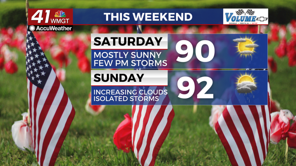
Saturday should be mostly sunny until the late afternoon and evening hours draw on. A few storms could be possible late in the afternoon and evening. Highs will be in the upper 80s and lower 90s with wind flowing from the northeast at 5 mph.


A Level 1 “Marginal” risk for severe weather includes most of Middle Georgia. The main threats will be a few strong wind gusts or some small hail.


Overnight a couple of storms will also be possible. Lows will be in the mid to upper 60s accompanied by light and variable winds.
Sunday and Memorial Day
While ample sun is expected early Sunday, clouds will fill in through the day and into the evening. Highs will climb largely into the lower 90s. Isolated storms will be likely over the back half of the day with the possibility that the strongest ones could be severe. A Level 1 “Marginal” risk currently exists for all of Middle Georgia on Sunday per the Storm Prediction Center (SPC). Primary risks for any storms that go severe would be strong winds or some hail.

Memorial Day will see increased rain odds as the stationary front continues to stick around. Those grilling may want to do it as more of a lunch thing as several scattered storms are likely over the latter half of the day.
Rain odds will remain high throughout next week.

Follow Chief Meteorologist Aaron Lowery on Facebook (Aaron Lowery 41NBC) and Twitter (@ALowWX) for weather updates throughout the day. Also, you can watch his forecasts Monday through Friday on 41NBC News at 4, 5, 5:30, 6, and 11 p.m.