Strong breezes will continue Thursday
MACON, Georgia (41NBC/WMGT) –
.
This Evening


What has been a sunny afternoon around Middle Georgia will see high clouds arrive through the late afternoon and evening. It will not be a blanket, however scattered clouds are expected through the evening and overnight hours. Low temperatures will be a lot cooler than last night as they fall into the lower 60s. One or two spots could drop into the upper 50s. Wind flow from the northwest at 5-10 mph. Gusts could still range 15-20 mph.
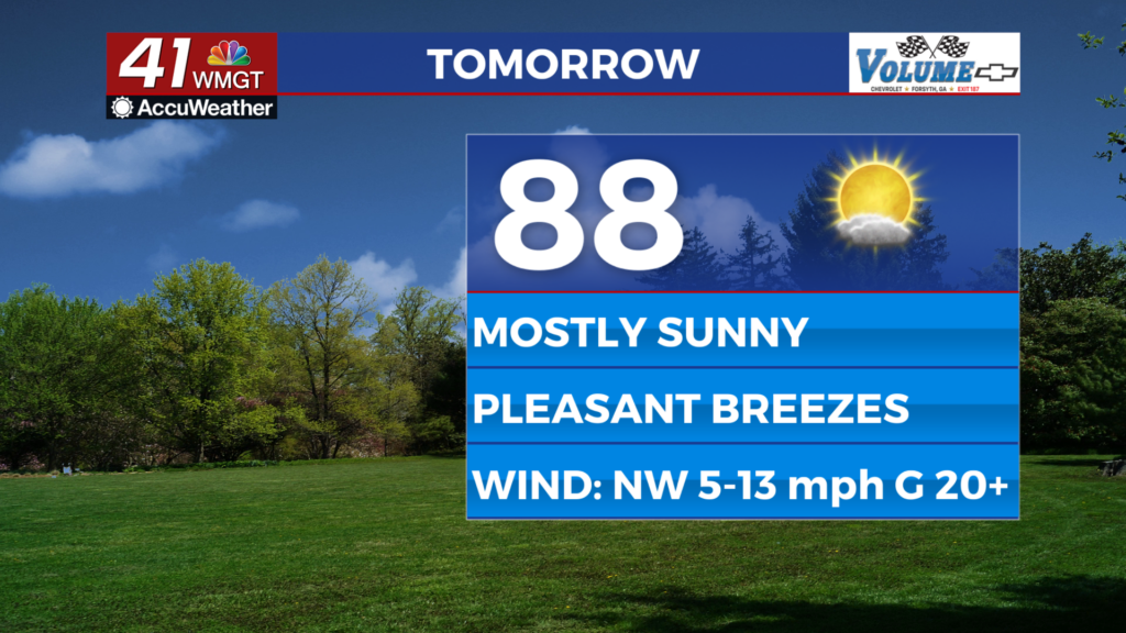
Tomorrow


Mostly sunny skies are likely Thursday as temperatures will largely reach the upper 80s. The hottest spots will see highs in the 90s again, however. Expect it to be breezy from the northwest as winds flow in at 5-15 mph with gusts ranging 20-25 mph.


Overnight cloud cover will return more and a few showers or perhaps a storm will be possible leading into Friday morning. This is courtesy of a surface trough that will become a cold front, leading to a bit more of a cooldown Friday afternoon. Low temperatures will be in the upper 50s and lower 60s rolling into Friday morning as well, accompanied by winds from the north-northwest around 5 mph.
Friday and Beyond


A couple of showers or maybe a storm could be ongoing through the sunrise hours as the aforementioned cold front passes through the region. Friday will be a cooler afternoon with highs largely expected in the mid 80s, however this cool down will be short lived as the 90s will return by Sunday afternoon. The weekend should see lower rain odds than recent weeks, however they will not be zero.

Follow Chief Meteorologist Aaron Lowery on Facebook (Aaron Lowery 41NBC) and Twitter (@ALowWX) for weather updates throughout the day. Also, you can watch his forecasts Monday through Friday on 41NBC News at 4, 5, 5:30, 6, and 11 p.m.