Friday brings on the summer heat
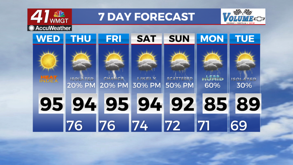
MACON, Georgia (41NBC/WMGT) – Temperatures will surge into the 90s across Middle Georgia to finish the work week.
This Evening


Mostly sunny skies have been seen across the region this afternoon and things should stay relatively clear heading into tonight. A few clouds will be possible during the overnight hours, however no rain is anticipated. Lows will largely be just below the 70 degree mark accompanied by a light wind from the west-southwest.
Tomorrow


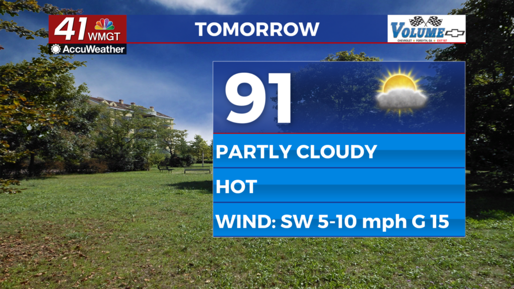
Friday will be a heater for Middle Georgia as temperatures climb into the lower 90s for the vast majority of the region. Expect heat indexes into the mid to upper 90s around the region. Wind will flow from the southwest at 5-10 mph, gusting to about 15 mph. Storms are not expected tomorrow in any capacity.


Overnight cloud cover will begin to increase leading up to Saturday morning. This is due to an incoming cold front from the north. Lows will again be just below the 70 degree mark for most of Middle Georgia as the wind gets a bit stronger from the southwest at 7-12 mph. Gusts could push 20 mph.
This Weekend


The aforementioned cold front is expected to move into Georgia Saturday, spurring on some rain chances for Middle Georgia during the morning hours. A second round of isolated storms could also be possible in the afternoon and evening. A Level 1 “Marginal” risk for severe weather currently includes the vast majority of Middle Georgia for Saturday.

More rain will be possible Sunday as the cold front stalls out and becomes stationary. This could bring even more widespread rain odds for the back half of the weekend. If there is a plus side, the added rain chances will keep temperatures Sunday out of the 90s in the afternoon. Expect the heat to return to begin next week.

Follow Chief Meteorologist Aaron Lowery on Facebook (Aaron Lowery 41NBC) and Twitter (@ALowWX) for weather updates throughout the day. Also, you can watch his forecasts Monday through Friday on 41NBC News at 4, 5, 5:30, 6, and 11 p.m.