More heat begins to return Wednesday
MACON, Georgia (41NBC/WMGT) – Rain chances will be even lower Wednesday as temperatures climb above average.
This Evening


Isolated storms are likely around Middle Georgia through the evening and into tonight. While severe weather is overall not expected, the strongest storms could bring some hail or a few strong wind gusts. Mostly cloudy skies will become partly cloudy during the overnight hours. Fog will be possible with calm wind from the southwest expected through the night. Low temperatures will be in the low to mid 60s across the region.
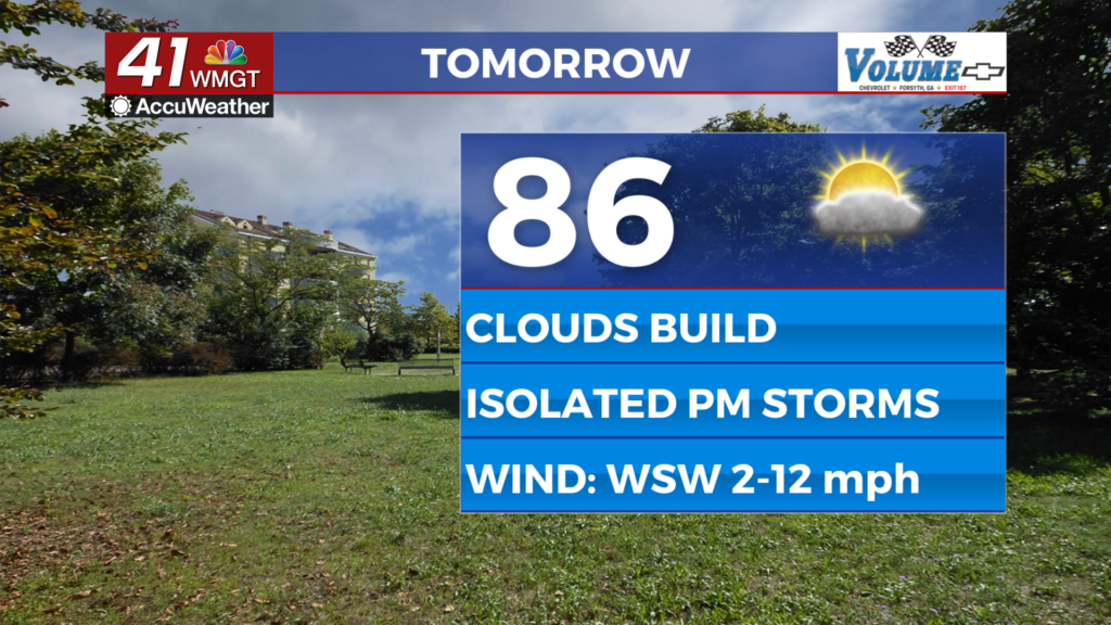
Tomorrow


It should be a relatively sunny start for Middle Georgia aside from any fog going on. Cloud cover will increase during the afternoon, however, and a couple of stray storms will be possible over the back half of the day. Highs will reach the mid to upper 80s with the hottest spots possibly reaching the 90 degree mark. Expect slight breezes from the west-southwest at 5-12 mph. Gusts could push as high as 20 mph.


Overnight will feature scattered clouds over a muggy Middle Georgia. Lows will largely fall in the mid 60s as ambient wind remains gentle from the southwest. A stray shower is possible, however rain odds overnight will be rather slim. Fog, however, will be possible ahead of Thursday morning.
Thursday and Beyond


The heat will turn up a notch Thursday as highs reach into the upper 80s and lower 90s across Middle Georgia under partly cloudy skies. Rain is unlikely as the system from early this week/this past weekend finally leaves the region. Temperatures into the 90s are expected to end the week and roll into the weekend.

Follow Chief Meteorologist Aaron Lowery on Facebook (Aaron Lowery 41NBC) and Twitter (@ALowWX) for weather updates throughout the day. Also, you can watch his forecasts Monday through Friday on 41NBC News at 4, 5, 5:30, 6, and 11 p.m.