


Spring-like temps for Wednesday gives way to showers and brief chill-down on Thursday
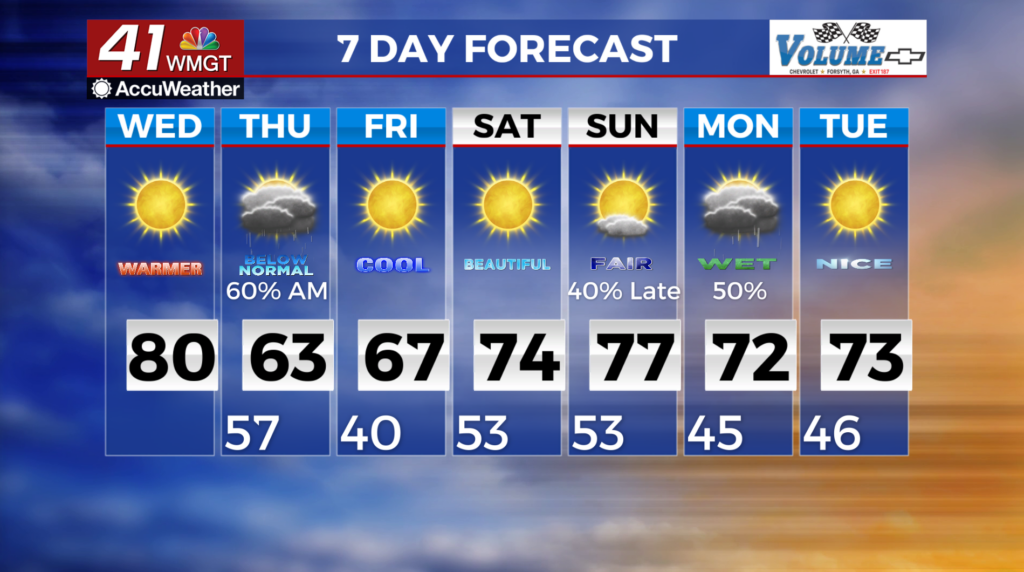
MACON. Georgia (41NBC/WMGT) – The key words for today are dry and warm. Highs this afternoon will reach into the upper 70s to low 80s across much of the area. Winds will be light as surface high pressure passes over the area. Relative humidity is well into the 20s, so it remains dry. Wednesday night, the main front arrives. The system will have trouble tapping into any subtropical moisture stream. Other systems have scoured a lot of moisture from the Gulf, so there is not a lot to work with. Therefore, we will remain dry with very low relative humidity values. With the low relative humidity and dry fuels, high fire danger becomes a concern Wednesday afternoon along with elevated winds and wind gusts. As the front arrives, a few storms and showers will develop and that will bring some rain chances. Overall amounts should be light, generally under a quarter of an inch, although areas that see a thunderstorm may get higher amounts. Severe level storms are not anticipated. These will move out of the state by the end of the morning. After the front passes, overnight lows likely fall close to or below freezing. Frost or freeze conditions are likely Friday morning. Temperatures will rebound by the weekend with highs in the low 70s and overnight lows in the 40s.